
Magnitude |
:2.8 |
| Date & Time (UTC) | 2012-07-26 04:44:22.7 |
| Date & Time (Local) | 1391/5/5 09:14:22.7 |
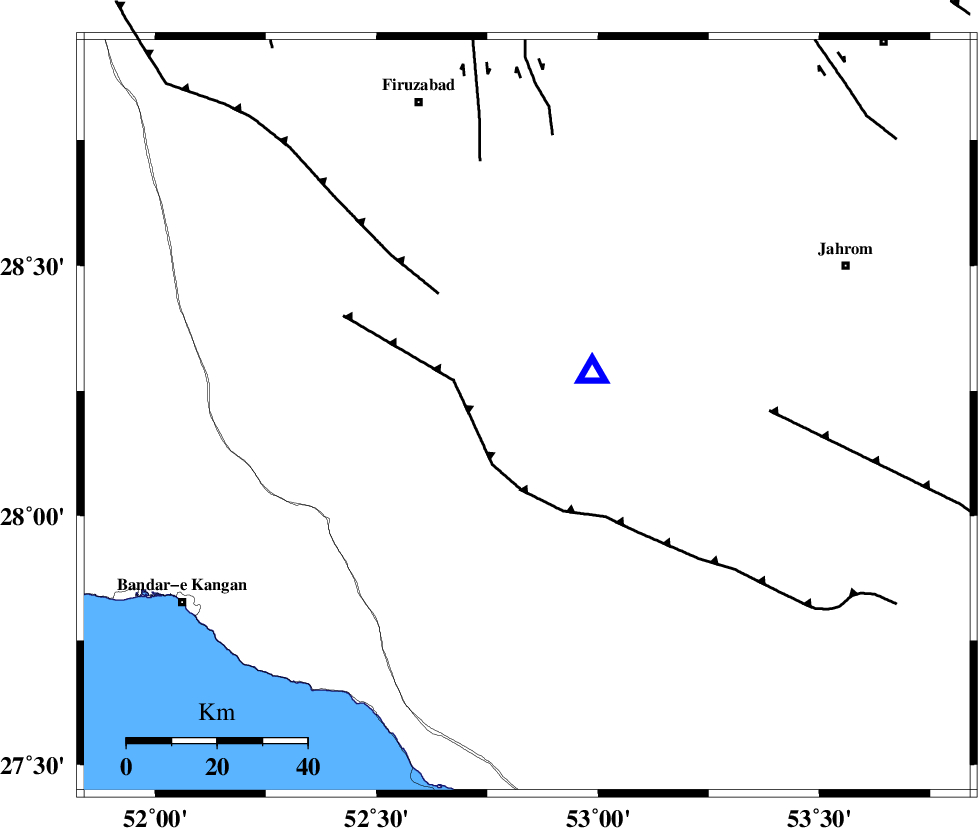
| Location | Lat:28.2 Lon: 52.84 |
| Region | Fars Province, 35 km South-West of Qir va Karzin |
Nearest Cities |
|
| 24 km North East of Garmesht, Fars Province | |
| 26 km South East of Hengam, Fars Province | |
| 30 km North West of Seyfabad, Fars Province | |
| 33 km South West of Shahrak-e jonubi, Fars Province | |
| 35 km South West of Qir va Karzin, Fars Province | |
| Depth | 14 km |
| Agency | |
Faults within 150 km: |
|
| QIR_F (Length: 130 km) , Distance to epicenter: 27 km | |
| SABZ_PUSHAN_F_Z1 (Length: 69 km) , Distance to epicenter: 58 km | |
| SABZ_PUSHAN_F_Z2 (Length: 24 km) , Distance to epicenter: 63 km | |
| Number of Phases | 4 |
| RMS | 0 |
| Number of Stations | 3 |
| Error in Latitude | >9.9 km |
| Error in Longitude | 1.5 km |
| Error in Depth | 3.6 km |
Download waveform in seisan format
to download seisan software Click here
to access information about IIEES stations Click here
Amplitude | ||||||||
| UID | Agency | Station | Component | Amplitude | Period | Arrival Time | Proccessing Time | Signal Clip |
| 84595 | IIEES | GHIR | E | 2807.6 | 0.21 | 2012-07-26 04:44:32 | 2012-07-26 04:57:00 | n |
| 84596 | IIEES | AHRM | N | 87.9 | 0.47 | 2012-07-26 04:45:16 | 2012-07-26 04:57:00 | n |
Phase | ||||||||||||
| Agency | Station | Component | Phase Type | Phase Quality | First Motion | Observed Arrival Time | Time Residual | Loc. Flag | Input Weight | Distance | Azimuth | |
| IIEES | GHIR | Z | Pg | E | 2012-07-26 04:44:26 | -0.02 | y | 17.2 | 58 | |||
| IIEES | AHRM | Z | Pg | E | 2012-07-26 04:44:50 | 0.01 | y | 168 | 296 | |||
| IIEES | AHRM | N | Sg | E | 2012-07-26 04:45:10 | -0.01 | y | 168 | 296 | |||
| IIEES | YZKH | Z | Pn | E | 2012-07-26 04:45:31 | 0.02 | y | 494 | 20 | |||