
Magnitude |
:2.3 |
| Date & Time (UTC) | 2012-07-19 20:13:31.7 |
| Date & Time (Local) | 1391/4/30 00:43:31.7 |
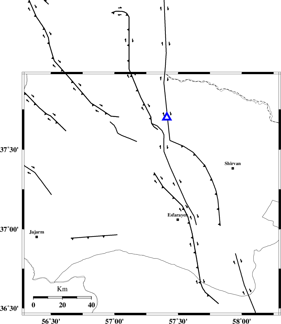
| Location | Lat:37.22 Lon: 57.29 |
| Region | Khorasan(north) Province, 29 km South of Bojnurd |
Nearest Cities |
|
| 14 km North East of Cheharborj, Khorasan(north) Province | |
| 16 km North West of Eraj, Khorasan(north) Province | |
| 19 km North of Zarqabad, Khorasan(north) Province | |
| 26 km North West of Esfarayen, Khorasan(north) Province | |
| 28 km South of Void, Khorasan(north) Province | |
| Depth | 38 km |
| Agency | |
Faults within 150 km: |
|
| ESFARAYEN_F (Length: 111 km) , Distance to epicenter: 7 km | |
| ROBATE_QARABIL_F (Length: 168 km) , Distance to epicenter: 29 km | |
| JAJARAM_F (Length: 77 km) , Distance to epicenter: 49 km | |
| Number of Phases | 5 |
| RMS | 0.1 |
| Number of Stations | 3 |
| Error in Latitude | >2.5 km |
| Error in Longitude | 4.7 km |
| Error in Depth | 3.3 km |
Download waveform in seisan format
to download seisan software Click here
to access information about IIEES stations Click here
Amplitude | ||||||||
| UID | Agency | Station | Component | Amplitude | Period | Arrival Time | Proccessing Time | Signal Clip |
| 84497 | IIEES | MRVT | E | 52.9 | 0.24 | 2012-07-19 20:14:08 | 2012-07-19 08:25:00 | n |
| 84498 | IIEES | MRVT | N | 70.6 | 0.28 | 2012-07-19 20:14:13 | 2012-07-19 08:25:00 | n |
| 84499 | IIEES | SHRO | E | 43.4 | 0.4 | 2012-07-19 20:14:24 | 2012-07-19 08:25:00 | n |
| 84500 | IIEES | SHRO | N | 42.3 | 0.32 | 2012-07-19 20:14:24 | 2012-07-19 08:25:00 | n |
Phase | ||||||||||||
| Agency | Station | Component | Phase Type | Phase Quality | First Motion | Observed Arrival Time | Time Residual | Loc. Flag | Input Weight | Distance | Azimuth | |
| IIEES | BJRD | N | Pg | E | 2012-07-19 20:13:42 | -0.17 | y | 54.5 | 11 | |||
| IIEES | BJRD | E | Sg | E | 2012-07-19 20:13:50 | 0.14 | y | 54.5 | 11 | |||
| IIEES | MRVT | Z | Pg | E | 2012-07-19 20:13:51 | -0.03 | y | 117 | 295 | |||
| IIEES | SHRO | Z | Pn | E | 2012-07-19 20:13:59 | 0.05 | y | 176 | 221 | |||
| IIEES | SHRO | E | Sg | E | 2012-07-19 20:14:21 | 0.01 | y | 176 | 221 | |||