
Magnitude |
:3.5 |
| Date & Time (UTC) | 2012-05-26 09:43:06.2 |
| Date & Time (Local) | 1391/3/6 14:13:06.2 |
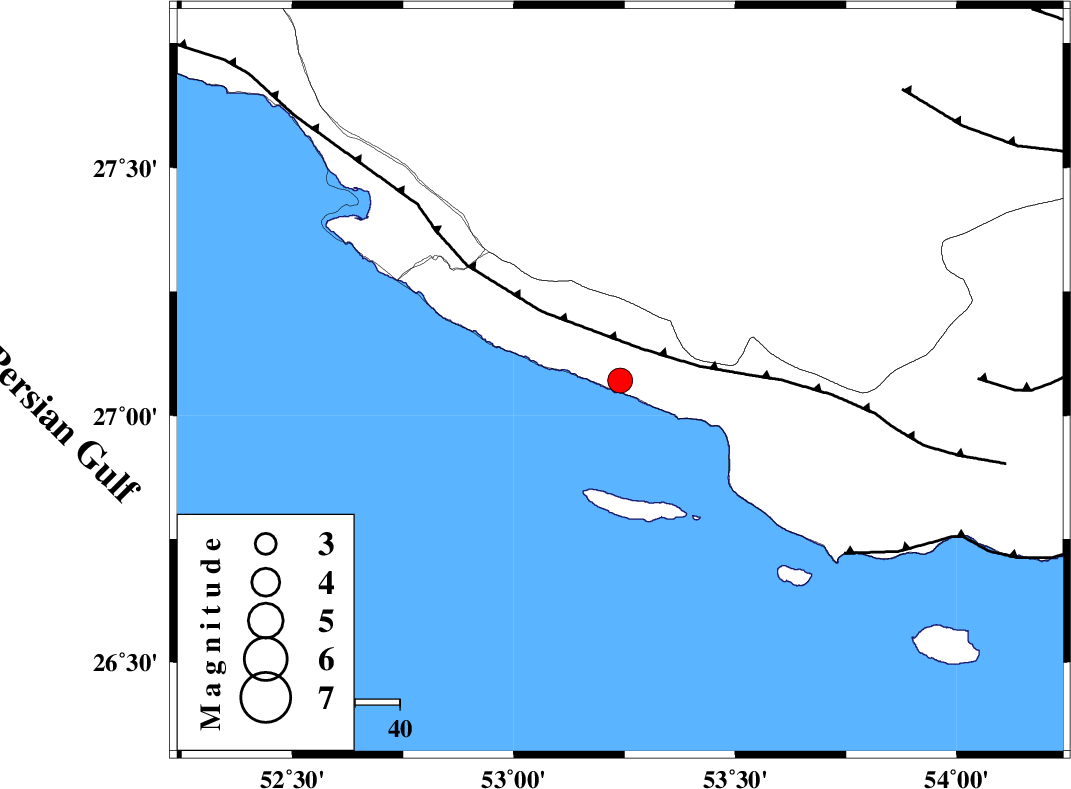
| Location | Lat:27.07 Lon: 53.24 |
| Region | Hormozgan Province, 31 km South of Lamerd |
Nearest Cities |
|
| 30 km South of Lamerd, Fars Province | |
| 41 km South West of Ashkenan, Fars Province | |
| 48 km South West of Beyram, Fars Province | |
| 49 km South East of Khoozi, Fars Province | |
| 50 km West of Ahl, Fars Province | |
| Depth | 14 km |
| Agency | |
Faults within 150 km: |
|
| MFF3 (Length: 292 km) , Distance to epicenter: 9 km | |
| ZFF1 (Length: 165 km) , Distance to epicenter: 63 km | |
| MFF1 (Length: 180 km) , Distance to epicenter: 80 km | |
| Number of Phases | 6 |
| RMS | 0.3 |
| Number of Stations | 5 |
| Error in Latitude | >7 km |
| Error in Longitude | 5.8 km |
| Error in Depth | 9.2 km |
Download waveform in seisan format
to download seisan software Click here
to access information about IIEES stations Click here
Amplitude | ||||||||
| UID | Agency | Station | Component | Amplitude | Period | Arrival Time | Proccessing Time | Signal Clip |
| 83777 | IIEES | GHIR | N | 830.1 | 0.36 | 2012-05-26 09:43:48 | 2012-05-26 10:09:00 | n |
| 83778 | IIEES | GHIR | E | 887.7 | 0.36 | 2012-05-26 09:43:49 | 2012-05-26 10:09:00 | n |
Phase | ||||||||||||
| Agency | Station | Component | Phase Type | Phase Quality | First Motion | Observed Arrival Time | Time Residual | Loc. Flag | Input Weight | Distance | Azimuth | |
| IIEES | GHIR | Z | Pg | E | 2012-05-26 09:43:28 | -0.43 | y | 137 | 349 | |||
| IIEES | GHIR | N | Sg | E | 2012-05-26 09:43:46 | 0.19 | y | 137 | 349 | |||
| IIEES | AHRM | Z | Pn | E | 2012-05-26 09:43:48 | 0.06 | y | 276 | 317 | |||
| IIEES | BNDS | Z | Pn | E | 2012-05-26 09:43:50 | 0.01 | y | 292 | 82 | |||
| IIEES | NASN | Z | Pn | E | 2012-05-26 09:44:33 | 0.41 | y | 637 | 356 | |||
| IIEES | TABS | Z | Pn | E | 2012-05-26 09:44:55 | -0.09 | y | 819 | 26 | |||