
Magnitude |
:3 |
| Date & Time (UTC) | 2012-05-25 20:32:48.9 |
| Date & Time (Local) | 1391/3/6 01:02:48.9 |
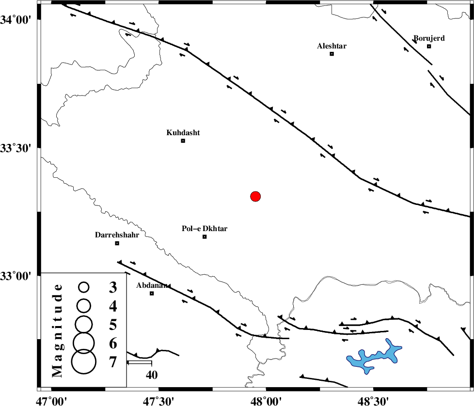
| Location | Lat:33.31 Lon: 47.95 |
| Region | Lorestan Province, 28 km North-East of Pol-e dokhtar |
Nearest Cities |
|
| 7 km of Maeulan, Lorestan Province | |
| 21 km South of Mahmudvand, Lorestan Province | |
| 22 km North East of Morani, Lorestan Province | |
| 24 km South West of Godar-e mahmudvand, Lorestan Province | |
| 25 km West of Shoorab-e sofla, Lorestan Province | |
| Depth | 14 km |
| Agency | |
Faults within 150 km: |
|
| HZF4 (Length: 492 km) , Distance to epicenter: 35 km | |
| BALARUD_F_Z1 (Length: 87 km) , Distance to epicenter: 52 km | |
| BALARUD_F_Z3 (Length: 53 km) , Distance to epicenter: 53 km | |
| Number of Phases | 6 |
| RMS | 0.2 |
| Number of Stations | 5 |
| Error in Latitude | >2.3 km |
| Error in Longitude | 3.4 km |
| Error in Depth | 5.4 km |
Download waveform in seisan format
to download seisan software Click here
to access information about IIEES stations Click here
Amplitude | ||||||||
| UID | Agency | Station | Component | Amplitude | Period | Arrival Time | Proccessing Time | Signal Clip |
| 83766 | IIEES | SHGR | N | 370.4 | 0.4 | 2012-05-25 20:33:40 | 2012-05-25 08:44:00 | n |
| 83767 | IIEES | SHGR | E | 286.2 | 0.36 | 2012-05-25 20:33:42 | 2012-05-25 08:44:00 | n |
| 83768 | IIEES | SNGE | N | 162.3 | 0.64 | 2012-05-25 20:33:54 | 2012-05-25 08:44:00 | n |
| 83769 | IIEES | SNGE | E | 71.6 | 0.56 | 2012-05-25 20:33:55 | 2012-05-25 08:44:00 | n |
| 83770 | IIEES | ASAO | E | 71.4 | 0.52 | 2012-05-25 20:34:06 | 2012-05-25 08:44:00 | n |
| 83771 | IIEES | GHVR | E | 45.8 | 0.52 | 2012-05-25 20:34:32 | 2012-05-25 08:44:00 | n |
| 83772 | IIEES | GHVR | N | 46.5 | 0.8 | 2012-05-25 20:34:35 | 2012-05-25 08:44:00 | n |
Phase | ||||||||||||
| Agency | Station | Component | Phase Type | Phase Quality | First Motion | Observed Arrival Time | Time Residual | Loc. Flag | Input Weight | Distance | Azimuth | |
| IIEES | SHGR | Z | Pg | E | 2012-05-25 20:33:14 | -0.17 | y | 156 | 149 | |||
| IIEES | KHMZ | Z | Pn | E | 2012-05-25 20:33:20 | -0.08 | y | 193 | 75 | |||
| IIEES | SNGE | Z | Pn | E | 2012-05-25 20:33:22 | 0.06 | y | 205 | 345 | |||
| IIEES | SNGE | N | Sg | E | 2012-05-25 20:33:47 | -0.15 | y | 205 | 345 | |||
| IIEES | ASAO | Z | Pn | E | 2012-05-25 20:33:26 | 0.49 | y | 236 | 54 | |||
| IIEES | ASAO | E | Sg | E | 2012-05-25 20:33:55 | -0.16 | y | 236 | 54 | |||