
Magnitude |
:2.2 |
| Date & Time (UTC) | 2012-04-25 09:51:48.8 |
| Date & Time (Local) | 1391/2/6 14:21:48.8 |
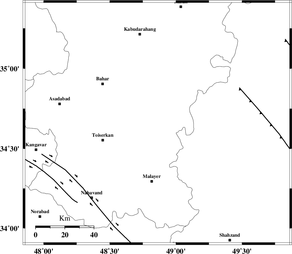
| Location | Lat:34.66 Lon: 48.86 |
| Region | Hamedan Province, 40 km North of Malayer |
Nearest Cities |
|
| 11 km West of Void, Hamedan Province | |
| 11 km East of Gonbad, Hamedan Province | |
| 14 km North of Eslamabad, Hamedan Province | |
| 26 km East of Qonjan, Hamedan Province | |
| 26 km South West of Qahavand, Hamedan Province | |
| Depth | 18 km |
| Agency | |
Faults within 150 km: |
|
| TAFRESH_F (Length: 117 km) , Distance to epicenter: 62 km | |
| NAHAVAND_F (Length: 102 km) , Distance to epicenter: 69 km | |
| SAHANEH_F (Length: 77 km) , Distance to epicenter: 78 km | |
| Number of Phases | 4 |
| RMS | 0.1 |
| Number of Stations | 4 |
| Error in Latitude | >4 km |
| Error in Longitude | 3.6 km |
| Error in Depth | 27.2 km |
Download waveform in seisan format
to download seisan software Click here
to access information about IIEES stations Click here
Amplitude | ||||||||
| UID | Agency | Station | Component | Amplitude | Period | Arrival Time | Proccessing Time | Signal Clip |
| 83076 | IIEES | KHMZ | N | 49.4 | 0.28 | 2012-04-25 09:52:32 | 2012-04-25 10:47:00 | n |
| 83077 | IIEES | KHMZ | E | 48.2 | 0.2 | 2012-04-25 09:52:33 | 2012-04-25 10:47:00 | n |
| 83078 | IIEES | SNGE | N | 43.8 | 0.44 | 2012-04-25 09:52:33 | 2012-04-25 10:47:00 | n |
| 83079 | IIEES | SNGE | E | 29.1 | 0.24 | 2012-04-25 09:52:34 | 2012-04-25 10:47:00 | n |
| 83080 | IIEES | GHVR | E | 15 | 0.28 | 2012-04-25 09:52:54 | 2012-04-25 10:47:00 | n |
| 83081 | IIEES | GHVR | N | 12.4 | 0.4 | 2012-04-25 09:52:57 | 2012-04-25 10:47:00 | n |
Phase | ||||||||||||
| Agency | Station | Component | Phase Type | Phase Quality | First Motion | Observed Arrival Time | Time Residual | Loc. Flag | Input Weight | Distance | Azimuth | |
| IIEES | ASAO | Z | Pg | E | 2012-04-25 09:52:08 | 0.03 | y | 108 | 96 | |||
| IIEES | KHMZ | Z | Pg | E | 2012-04-25 09:52:13 | -0.19 | y | 144 | 134 | |||
| IIEES | KHMZ | E | Sg | E | 2012-04-25 09:52:31 | 0.12 | y | 144 | 134 | |||
| IIEES | SNGE | Z | Pg | E | 2012-04-25 09:52:13 | 0.04 | y | 146 | 290 | |||