
Magnitude |
:2.9 |
| Date & Time (UTC) | 2012-04-04 01:27:00.9 |
| Date & Time (Local) | 1391/1/16 05:57:00.9 |
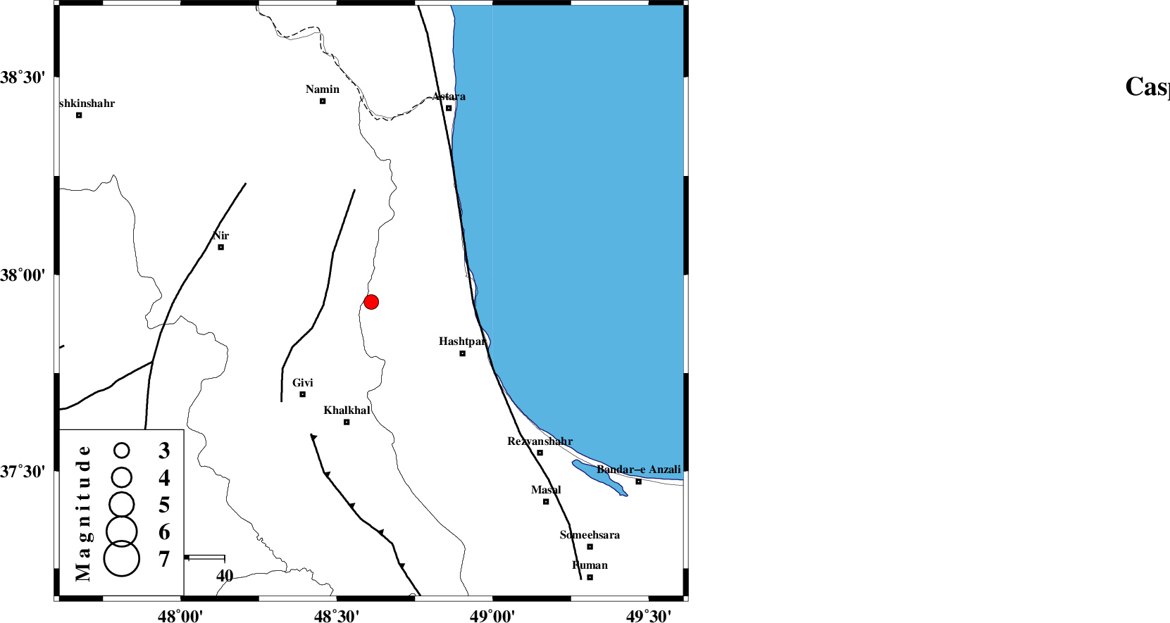
| Location | Lat:37.93 Lon: 48.61 |
| Region | Gilan Province, 34 km North of Khalkhal |
Nearest Cities |
|
| 21 km North West of Kish dini, Gilan Province | |
| 21 km South East of Budalalu, Ardebil Province | |
| 24 km South of Hir, Ardebil Province | |
| 25 km South East of Mehmandust, Ardebil Province | |
| 28 km North West of Chelonasr, Gilan Province | |
| Depth | 14 km |
| Agency | |
Faults within 150 km: |
|
| SANGAVAR_F (Length: 61 km) , Distance to epicenter: 13 km | |
| TALESH_F (Length: 258 km) , Distance to epicenter: 29 km | |
| MASULEL_F (Length: 90 km) , Distance to epicenter: 41 km | |
| Number of Phases | 5 |
| RMS | 0 |
| Number of Stations | 4 |
| Error in Latitude | >1.4 km |
| Error in Longitude | 3.5 km |
| Error in Depth | 4 km |
Download waveform in seisan format
to download seisan software Click here
to access information about IIEES stations Click here
Amplitude | ||||||||
| UID | Agency | Station | Component | Amplitude | Period | Arrival Time | Proccessing Time | Signal Clip |
| 82636 | IIEES | GRMI | E | 344 | 0.32 | 2012-04-04 01:27:36 | 2012-04-04 02:02:00 | n |
| 82637 | IIEES | GRMI | N | 252 | 0.16 | 2012-04-04 01:27:36 | 2012-04-04 02:02:00 | n |
| 82638 | IIEES | ZNJK | E | 160.3 | 0.36 | 2012-04-04 01:27:44 | 2012-04-04 02:02:00 | n |
Phase | ||||||||||||
| Agency | Station | Component | Phase Type | Phase Quality | First Motion | Observed Arrival Time | Time Residual | Loc. Flag | Input Weight | Distance | Azimuth | |
| IIEES | GRMI | Z | Pg | E | 2012-04-04 01:27:20 | 0.07 | y | 116 | 328 | |||
| IIEES | GRMI | E | Sg | E | 2012-04-04 01:27:34 | -0.05 | y | 116 | 328 | |||
| IIEES | ZNJK | Z | Pg | E | 2012-04-04 01:27:24 | -0.02 | y | 140 | 177 | |||
| IIEES | SNGE | Z | Pn | E | 2012-04-04 01:27:50 | 0.01 | y | 334 | 200 | |||
| IIEES | MRVT | Z | Pn | E | 2012-04-04 01:28:30 | -0.01 | y | 660 | 90 | |||