
Magnitude |
:3.2 |
| Date & Time (UTC) | 2012-03-26 17:22:31.4 |
| Date & Time (Local) | 1391/1/7 21:52:31.4 |
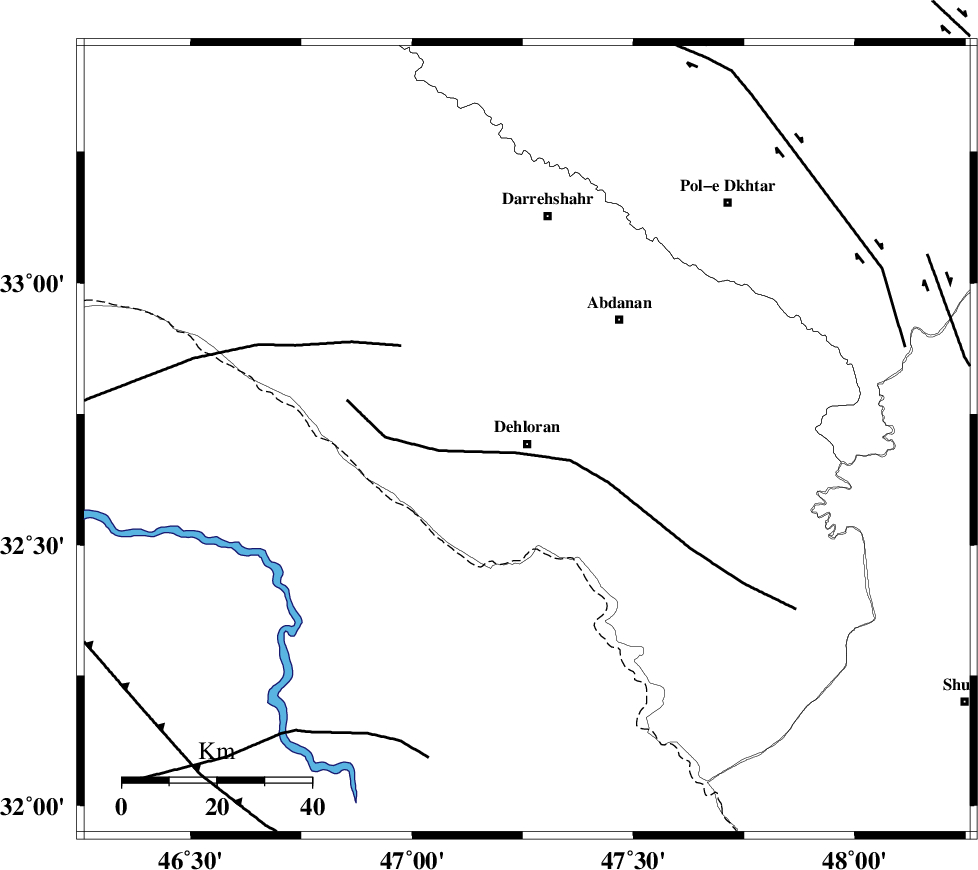
| Location | Lat:32.7 Lon: 47.26 |
| Region | Ilam Province, 1 km Dehloran |
Nearest Cities |
|
| 1 km North of Dehloran, Ilam Province | |
| 20 km North West of Musian, Ilam Province | |
| 30 km South East of Bishehzar, Ilam Province | |
| 32 km South West of Abdanan, Ilam Province | |
| 36 km South West of Sarabbagh, Ilam Province | |
| Depth | 18 km |
| Agency | |
Faults within 150 km: |
|
| MFF6 (Length: 144 km) , Distance to epicenter: 7 km | |
| BALARUD_F_Z1 (Length: 87 km) , Distance to epicenter: 40 km | |
| BALARUD_F_Z3 (Length: 53 km) , Distance to epicenter: 76 km | |
| Number of Phases | 6 |
| RMS | 0.2 |
| Number of Stations | 5 |
| Error in Latitude | >3.1 km |
| Error in Longitude | 6.4 km |
| Error in Depth | 7.1 km |
Download waveform in seisan format
to download seisan software Click here
to access information about IIEES stations Click here
Amplitude | ||||||||
| UID | Agency | Station | Component | Amplitude | Period | Arrival Time | Proccessing Time | Signal Clip |
| 82551 | IIEES | SHGR | N | 378.9 | 0.28 | 2012-03-26 17:23:21 | 2012-03-26 05:58:00 | n |
| 82552 | IIEES | SHGR | E | 489 | 0.6 | 2012-03-26 17:23:23 | 2012-03-26 05:58:00 | n |
| 82553 | IIEES | SNGE | E | 82.4 | 0.48 | 2012-03-26 17:23:53 | 2012-03-26 05:58:00 | n |
| 82554 | IIEES | SNGE | N | 69.9 | 0.44 | 2012-03-26 17:23:57 | 2012-03-26 05:58:00 | n |
| 82555 | IIEES | GHVR | E | 38.5 | 0.52 | 2012-03-26 17:24:22 | 2012-03-26 05:58:00 | n |
Phase | ||||||||||||
| Agency | Station | Component | Phase Type | Phase Quality | First Motion | Observed Arrival Time | Time Residual | Loc. Flag | Input Weight | Distance | Azimuth | |
| IIEES | SHGR | Z | Pg | E | 2012-03-26 17:22:57 | 0.16 | y | 160 | 114 | |||
| IIEES | SNGE | Z | Pn | E | 2012-03-26 17:23:11 | 0.14 | y | 265 | 2 | |||
| IIEES | KHMZ | Z | Pn | E | 2012-03-26 17:23:13 | -0.36 | y | 277 | 65 | |||
| IIEES | ASAO | Z | Pn | E | 2012-03-26 17:23:19 | -0.07 | y | 329 | 51 | |||
| IIEES | ASAO | N | Sg | E | 2012-03-26 17:24:03 | 0.09 | y | 329 | 51 | |||
| IIEES | GHVR | Z | Pn | E | 2012-03-26 17:23:30 | 0.05 | y | 420 | 61 | |||