
Magnitude |
:2.5 |
| Date & Time (UTC) | 2012-03-18 06:59:10.2 |
| Date & Time (Local) | 1390/12/28 10:29:10.2 |
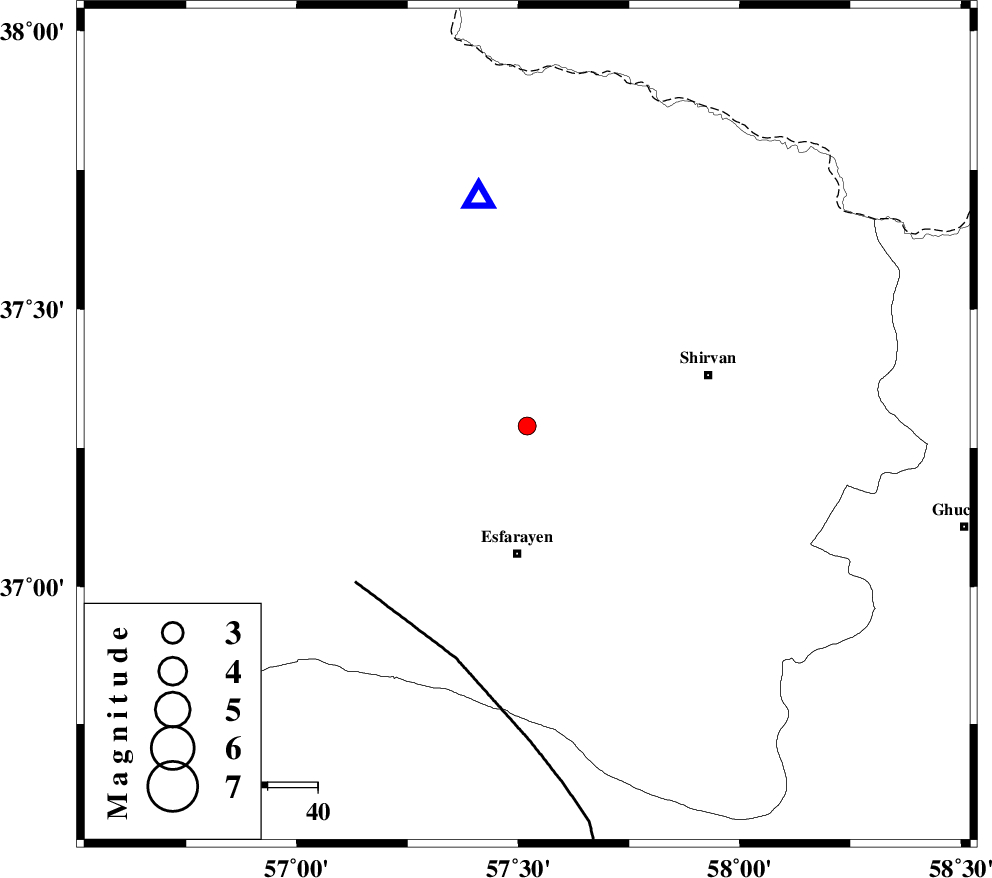
| Location | Lat:37.29 Lon: 57.52 |
| Region | Khorasan(north) Province, 26 km North of Esfarayen |
Nearest Cities |
|
| 19 km West of Zavarom, Khorasan(north) Province | |
| 21 km North East of Eraj, Khorasan(north) Province | |
| 25 km South of Hesar-egarmkhanh, Khorasan(north) Province | |
| 26 km North of Parkanlu, Khorasan(north) Province | |
| 26 km North of Esfarayen, Khorasan(north) Province | |
| Depth | 17 km |
| Agency | |
Faults within 150 km: |
|
| ESFARAYEN_F (Length: 111 km) , Distance to epicenter: 20 km | |
| ROBATE_QARABIL_F (Length: 168 km) , Distance to epicenter: 46 km | |
| BAGHAN_GERMAB_F (Length: 79 km) , Distance to epicenter: 55 km | |
| Number of Phases | 5 |
| RMS | 0 |
| Number of Stations | 4 |
| Error in Latitude | >1.8 km |
| Error in Longitude | 4.5 km |
| Error in Depth | 5.9 km |
Download waveform in seisan format
to download seisan software Click here
to access information about IIEES stations Click here
Amplitude | ||||||||
| UID | Agency | Station | Component | Amplitude | Period | Arrival Time | Proccessing Time | Signal Clip |
| 82404 | IIEES | BJRD | E | 427.8 | 0.17 | 2012-03-18 06:59:27 | 2012-03-18 06:12:00 | n |
| 82405 | IIEES | MRVT | N | 82.1 | 0.4 | 2012-03-18 06:59:56 | 2012-03-18 06:12:00 | n |
Phase | ||||||||||||
| Agency | Station | Component | Phase Type | Phase Quality | First Motion | Observed Arrival Time | Time Residual | Loc. Flag | Input Weight | Distance | Azimuth | |
| IIEES | BJRD | Z | Pg | E | 2012-03-18 06:59:18 | 0.01 | y | 46.5 | 348 | |||
| IIEES | MRVT | Z | Pg | E | 2012-03-18 06:59:32 | -0.01 | y | 133 | 288 | |||
| IIEES | SHRO | Z | Pg | E | 2012-03-18 06:59:42 | -0.02 | y | 196 | 224 | |||
| IIEES | SHRO | N | Sg | E | 2012-03-18 07:00:06 | 0.01 | y | 196 | 224 | |||
| IIEES | TABS | Z | Pn | E | 2012-03-18 07:00:08 | 0 | y | 406 | 185 | |||