
Magnitude |
:3.6 |
| Date & Time (UTC) | 2012-03-13 00:30:26.1 |
| Date & Time (Local) | 1390/12/23 04:00:26.1 |
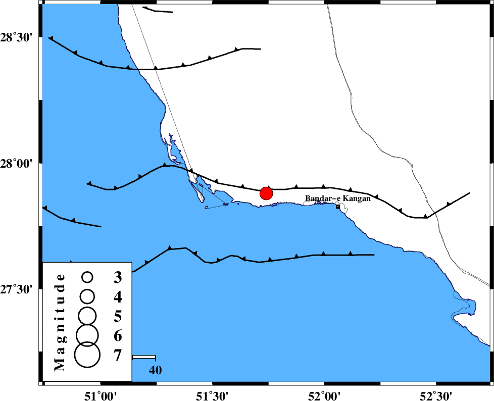
| Location | Lat:27.88 Lon: 51.74 |
| Region | Bushehr Province, 32 km West of Bandar-e kangan |
Nearest Cities |
|
| 22 km South of Abdan, Bushehr Province | |
| 32 km North West of Bandar-e kangan, Bushehr Province | |
| 33 km South East of Bardkhun, Bushehr Province | |
| 37 km South West of Riz, Bushehr Province | |
| 38 km South East of Abkesh, Bushehr Province | |
| Depth | 29 km |
| Agency | |
Faults within 150 km: |
|
| BORAZJAN_F (Length: 168 km) , Distance to epicenter: 22 km | |
| MFF3 (Length: 292 km) , Distance to epicenter: 22 km | |
| ZFF2 (Length: 84 km) , Distance to epicenter: 46 km | |
| Number of Phases | 6 |
| RMS | 0.2 |
| Number of Stations | 4 |
| Error in Latitude | >5.8 km |
| Error in Longitude | 3.1 km |
| Error in Depth | 5.6 km |
Download waveform in seisan format
to download seisan software Click here
to access information about IIEES stations Click here
Amplitude | ||||||||
| UID | Agency | Station | Component | Amplitude | Period | Arrival Time | Proccessing Time | Signal Clip |
| 82327 | IIEES | GHIR | E | 1138.7 | 0.52 | 2012-03-13 00:31:08 | 2012-03-13 12:00:00 | n |
| 82328 | IIEES | GHIR | N | 1113.4 | 0.44 | 2012-03-13 00:31:08 | 2012-03-13 12:00:00 | n |
Phase | ||||||||||||
| Agency | Station | Component | Phase Type | Phase Quality | First Motion | Observed Arrival Time | Time Residual | Loc. Flag | Input Weight | Distance | Azimuth | |
| IIEES | AHRM | Z | Pg | E | 2012-03-13 00:30:45 | 0.09 | y | 117 | 338 | |||
| IIEES | AHRM | N | Sg | E | 2012-03-13 00:30:59 | 0 | y | 117 | 338 | |||
| IIEES | GHIR | Z | Pg | E | 2012-03-13 00:30:47 | -0.06 | y | 131 | 70 | |||
| IIEES | GHIR | N | Sg | E | 2012-03-13 00:31:03 | -0.04 | y | 131 | 70 | |||
| IIEES | KRBR | Z | Pn | E | 2012-03-13 00:31:40 | 0.21 | y | 542 | 63 | |||
| IIEES | SNGE | Z | Pn | E | 2012-03-13 00:32:24 | -0.49 | y | 901 | 334 | |||