
Magnitude |
:3.5 |
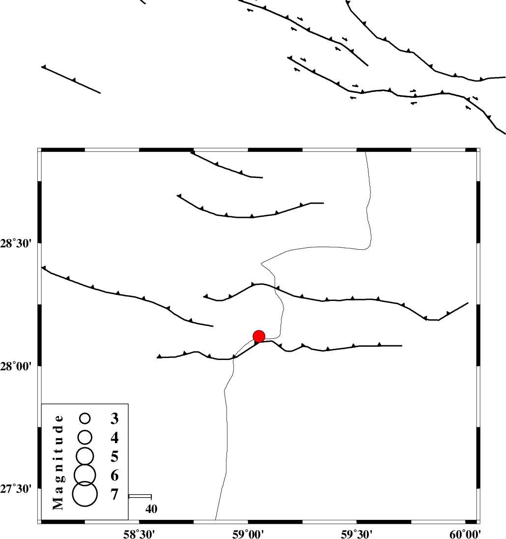
| Date & Time (UTC) | 2012-03-11 05:31:32.2 |
| Date & Time (Local) | 1390/12/21 09:01:32.2 |
| Location | Lat:28.12 Lon: 59.05 |
| Region | Kerman Province, 135 km North-East of Kahnuj |
Nearest Cities |
|
| 54 km North East of Borj-e abbasabad, Kerman Province | |
| 65 km South of Hoseynabad, Kerman Province | |
| 68 km South East of Mohammadabad-e gonbaki, Kerman Province | |
| 83 km North West of Kalemursi, Sistan va Baloochestan Province | |
| 85 km South East of Void, Kerman Province | |
| Depth | 15 km |
| Agency | |
Faults within 150 km: |
|
| BAM_F (Length: 118 km) , Distance to epicenter: 29 km | |
| KANURAK_F (Length: 135 km) , Distance to epicenter: 108 km | |
| KASKIN_F (Length: 100 km) , Distance to epicenter: 118 km | |
| Number of Phases | 4 |
| RMS | 0.4 |
| Number of Stations | 4 |
| Error in Latitude | >5.2 km |
| Error in Longitude | 3.8 km |
| Error in Depth | 0 km |
Download waveform in seisan format
to download seisan software Click here
to access information about IIEES stations Click here
Amplitude | ||||||||
| UID | Agency | Station | Component | Amplitude | Period | Arrival Time | Proccessing Time | Signal Clip |
| 82264 | IIEES | BNDS | N | 161 | 0.37 | 2012-03-11 05:32:56 | 2012-03-11 04:45:00 | n |
| 82265 | IIEES | BNDS | E | 254.3 | 0.41 | 2012-03-11 05:33:01 | 2012-03-11 04:45:00 | n |
Phase | ||||||||||||
| Agency | Station | Component | Phase Type | Phase Quality | First Motion | Observed Arrival Time | Time Residual | Loc. Flag | Input Weight | Distance | Azimuth | |
| IIEES | ZHSF | Z | Pn | E | 2012-03-11 05:32:08 | -0.3 | y | 235 | 45 | |||
| IIEES | BNDS | Z | Pn | E | 2012-03-11 05:32:16 | -0.5 | y | 295 | 255 | |||
| IIEES | KRBR | Z | Pn | E | 2012-03-11 05:32:18 | 0.54 | y | 304 | 313 | |||
| IIEES | CHBR | Z | Pn | E | 2012-03-11 05:32:19 | 0.3 | y | 314 | 153 | |||