
Magnitude |
:3.1 |
| Date & Time (UTC) | 2012-03-08 20:33:09.0 |
| Date & Time (Local) | 1390/12/19 00:03:09.0 |
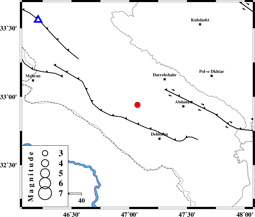
| Location | Lat:32.94 Lon: 47.07 |
| Region | Ilam Province, 37 km West of Abdanan |
Nearest Cities |
|
| 16 km North of Bishehzar, Ilam Province | |
| 30 km South West of Darreh Shahr, Ilam Province | |
| 33 km North West of Dehloran, Ilam Province | |
| 35 km South East of Meymeh, Ilam Province | |
| 35 km South West of Dashtabad-e olia, Ilam Province | |
| Depth | 46 km |
| Agency | |
Faults within 150 km: |
|
| MFF6 (Length: 144 km) , Distance to epicenter: 14 km | |
| BALARUD_F_Z1 (Length: 87 km) , Distance to epicenter: 25 km | |
| MFF7 (Length: 99 km) , Distance to epicenter: 60 km | |
| Number of Phases | 5 |
| RMS | 0.1 |
| Number of Stations | 4 |
| Error in Latitude | >4.2 km |
| Error in Longitude | 8.9 km |
| Error in Depth | 3.6 km |
Download waveform in seisan format
to download seisan software Click here
to access information about IIEES stations Click here
Amplitude | ||||||||
| UID | Agency | Station | Component | Amplitude | Period | Arrival Time | Proccessing Time | Signal Clip |
| 82210 | IIEES | SHGR | N | 182.4 | 0.52 | 2012-03-08 20:34:07 | 2012-03-08 08:01:00 | n |
| 82211 | IIEES | SHGR | E | 211.8 | 0.32 | 2012-03-08 20:34:09 | 2012-03-08 08:01:00 | n |
| 82212 | IIEES | SNGE | N | 93.9 | 0.44 | 2012-03-08 20:34:22 | 2012-03-08 08:01:00 | n |
| 82213 | IIEES | SNGE | E | 122.1 | 0.52 | 2012-03-08 20:34:22 | 2012-03-08 08:01:00 | n |
Phase | ||||||||||||
| Agency | Station | Component | Phase Type | Phase Quality | First Motion | Observed Arrival Time | Time Residual | Loc. Flag | Input Weight | Distance | Azimuth | |
| IIEES | SHGR | N | Sg | E | 2012-03-08 20:34:01 | 0.01 | y | 187 | 119 | |||
| IIEES | SNGE | Z | Pn | E | 2012-03-08 20:33:43 | 0 | y | 240 | 6 | |||
| IIEES | SNGE | E | Sg | E | 2012-03-08 20:34:16 | -0.01 | y | 240 | 6 | |||
| IIEES | KHMZ | Z | Pn | E | 2012-03-08 20:33:49 | -0.13 | y | 284 | 71 | |||
| IIEES | ASAO | Z | Pn | E | 2012-03-08 20:33:54 | 0.14 | y | 327 | 56 | |||