
Magnitude |
:3.5 |
| Date & Time (UTC) | 2012-03-01 02:30:58.5 |
| Date & Time (Local) | 1390/12/11 06:00:58.5 |
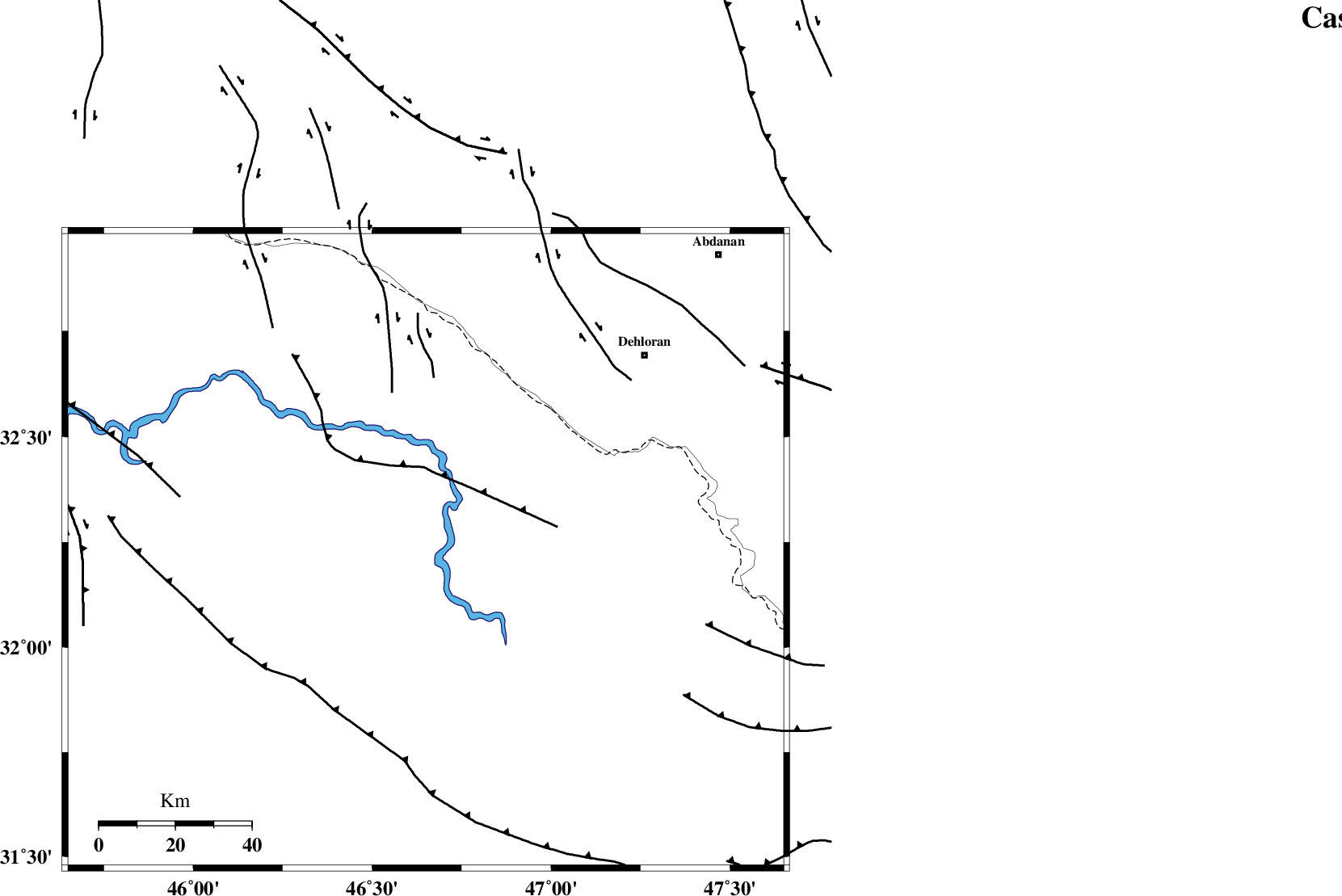
| Location | Lat:32.23 Lon: 46.65 |
| Region | Iraq, 77 km South-West of Dehloran |
Nearest Cities |
|
| 73 km South West of Bishehzar, Ilam Province | |
| 75 km South West of Musian, Ilam Province | |
| 77 km South West of Dehloran, Ilam Province | |
| 109 km South East of Mehran, Ilam Province | |
| 109 km South West of Abdanan, Ilam Province | |
| Depth | 18 km |
| Agency | |
Faults within 150 km: |
|
| MFF6 (Length: 144 km) , Distance to epicenter: 73 km | |
| ZFF4 (Length: 128 km) , Distance to epicenter: 104 km | |
| BALARUD_F_Z1 (Length: 87 km) , Distance to epicenter: 110 km | |
| Number of Phases | 6 |
| RMS | 0.1 |
| Number of Stations | 4 |
| Error in Latitude | >7.9 km |
| Error in Longitude | 12 km |
| Error in Depth | 12.7 km |
Download waveform in seisan format
to download seisan software Click here
to access information about IIEES stations Click here
Amplitude | ||||||||
| UID | Agency | Station | Component | Amplitude | Period | Arrival Time | Proccessing Time | Signal Clip |
| 82109 | IIEES | SHGR | E | 444.9 | 0.88 | 2012-03-01 02:32:01 | 2012-03-01 02:17:00 | n |
Phase | ||||||||||||
| Agency | Station | Component | Phase Type | Phase Quality | First Motion | Observed Arrival Time | Time Residual | Loc. Flag | Input Weight | Distance | Azimuth | |
| IIEES | SHGR | Z | Pn | E | 2012-03-01 02:31:30 | -0.02 | y | 203 | 93 | |||
| IIEES | SHGR | E | Sg | E | 2012-03-01 02:31:56 | 0 | y | 203 | 93 | |||
| IIEES | SNGE | Z | P | E | 2012-03-01 02:31:46 | 0.02 | y | 324 | 11 | |||
| IIEES | SNGE | E | Sg | E | 2012-03-01 02:32:29 | 0 | y | 324 | 11 | |||
| IIEES | KHMZ | Z | Pn | E | 2012-03-01 02:31:49 | 0.15 | y | 352 | 61 | |||
| IIEES | ASAO | Z | Pn | E | 2012-03-01 02:31:56 | -0.16 | y | 406 | 50 | |||