
Magnitude |
:4.3 |
| Date & Time (UTC) | 2012-02-29 13:22:55.3 |
| Date & Time (Local) | 1390/12/10 16:52:55.3 |
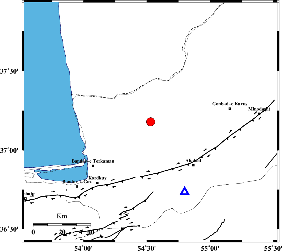
| Location | Lat:37.18 Lon: 54.53 |
| Region | Golestan Province, 19 km North of Aq Qaleh |
Nearest Cities |
|
| 19 km North of Qanqarmeh, Golestan Province | |
| 20 km North of Aq Qaleh, Golestan Province | |
| 21 km North West of Gariduji, Golestan Province | |
| 23 km North of Nodeh malek, Golestan Province | |
| 33 km North East of Banavar, Golestan Province | |
| Depth | 14 km |
| Agency | |
Faults within 150 km: |
|
| KHAZAR_F (Length: 523 km) , Distance to epicenter: 36 km | |
| N_ALBORZ_F (Length: 360 km) , Distance to epicenter: 64 km | |
| SHAVAR_F (Length: 87 km) , Distance to epicenter: 69 km | |
| Number of Phases | 10 |
| RMS | 0.1 |
| Number of Stations | 7 |
| Error in Latitude | >1.4 km |
| Error in Longitude | 1.3 km |
| Error in Depth | 3 km |
Download waveform in seisan format
to download seisan software Click here
to access information about IIEES stations Click here
Amplitude | ||||||||
| UID | Agency | Station | Component | Amplitude | Period | Arrival Time | Proccessing Time | Signal Clip |
| 82096 | IIEES | MRVT | N | 4753.5 | 0.28 | 2012-02-29 13:23:41 | 2012-02-29 12:41:00 | n |
Phase | ||||||||||||
| Agency | Station | Component | Phase Type | Phase Quality | First Motion | Observed Arrival Time | Time Residual | Loc. Flag | Input Weight | Distance | Azimuth | |
| IIEES | MRVT | Z | Pg | E | 2012-02-29 13:23:19 | 0 | y | 148 | 68 | |||
| IIEES | MRVT | N | Sg | E | 2012-02-29 13:23:37 | 0.01 | y | 148 | 68 | |||
| IIEES | SHRO | Z | Pg | E | 2012-02-29 13:23:25 | -0.08 | y | 185 | 134 | |||
| IIEES | SHRO | N | Sg | E | 2012-02-29 13:23:48 | 0.06 | y | 185 | 134 | |||
| IIEES | DAMV | Z | Pn | E | 2012-02-29 13:23:38 | 0.15 | y | 287 | 234 | |||
| IIEES | DAMV | E | Sg | E | 2012-02-29 13:24:16 | -0.01 | y | 287 | 234 | |||
| IIEES | CHTH | Z | Pn | E | 2012-02-29 13:23:44 | -0.09 | y | 336 | 246 | |||
| IIEES | THKV | Z | Pn | E | 2012-02-29 13:23:47 | 0.13 | y | 356 | 248 | |||
| IIEES | GHVR | Z | Pn | E | 2012-02-29 13:23:55 | -0.08 | y | 421 | 226 | |||
| IIEES | ASAO | Z | Pn | E | 2012-02-29 13:24:05 | -0.15 | y | 500 | 236 | |||