
Magnitude |
:4.5 |
| Date & Time (UTC) | 2012-02-28 23:18:49.5 |
| Date & Time (Local) | 1390/12/10 02:48:49.5 |
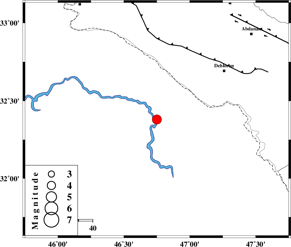
| Location | Lat:32.38 Lon: 46.75 |
| Region | Iraq, 59 km South-West of Dehloran |
Nearest Cities |
|
| 54 km South West of Bishehzar, Ilam Province | |
| 59 km South West of Dehloran, Ilam Province | |
| 60 km South West of Musian, Ilam Province | |
| 91 km South West of Abdanan, Ilam Province | |
| 96 km South West of Sarabbagh, Ilam Province | |
| Depth | 15 km |
| Agency | |
Faults within 150 km: |
|
| MFF6 (Length: 144 km) , Distance to epicenter: 54 km | |
| ZFF4 (Length: 128 km) , Distance to epicenter: 90 km | |
| BALARUD_F_Z1 (Length: 87 km) , Distance to epicenter: 91 km | |
| Number of Phases | 5 |
| RMS | 0.2 |
| Number of Stations | 5 |
| Error in Latitude | >3.6 km |
| Error in Longitude | 3.3 km |
| Error in Depth | 0 km |
Download waveform in seisan format
to download seisan software Click here
to access information about IIEES stations Click here
Amplitude | ||||||||
| UID | Agency | Station | Component | Amplitude | Period | Arrival Time | Proccessing Time | Signal Clip |
| 82065 | IIEES | SHGR | E | 4670 | 0.68 | 2012-02-28 23:19:50 | 2012-02-28 10:38:00 | n |
| 82066 | IIEES | SHGR | N | 3995 | 0.6 | 2012-02-28 23:20:09 | 2012-02-28 10:38:00 | n |
| 82067 | IIEES | SNGE | N | 1288.2 | 0.68 | 2012-02-28 23:20:20 | 2012-02-28 10:38:00 | n |
| 82068 | IIEES | SNGE | E | 2326.9 | 0.76 | 2012-02-28 23:20:28 | 2012-02-28 10:38:00 | n |
Phase | ||||||||||||
| Agency | Station | Component | Phase Type | Phase Quality | First Motion | Observed Arrival Time | Time Residual | Loc. Flag | Input Weight | Distance | Azimuth | |
| IIEES | SHGR | Z | Pn | E | 2012-02-28 23:19:21 | 0.22 | y | 196 | 98 | |||
| IIEES | SNGE | Z | Pn | E | 2012-02-28 23:19:35 | 0.08 | y | 305 | 10 | |||
| IIEES | KHMZ | Z | Pn | E | 2012-02-28 23:19:38 | -0.06 | y | 336 | 63 | |||
| IIEES | ASAO | Z | Pn | E | 2012-02-28 23:19:45 | -0.17 | y | 388 | 51 | |||
| IIEES | AHRM | Z | Pn | E | 2012-02-28 23:20:09 | -0.19 | y | 585 | 131 | |||