
Magnitude |
:2.3 |
| Date & Time (UTC) | 2012-02-26 13:31:52.7 |
| Date & Time (Local) | 1390/12/7 17:01:52.7 |
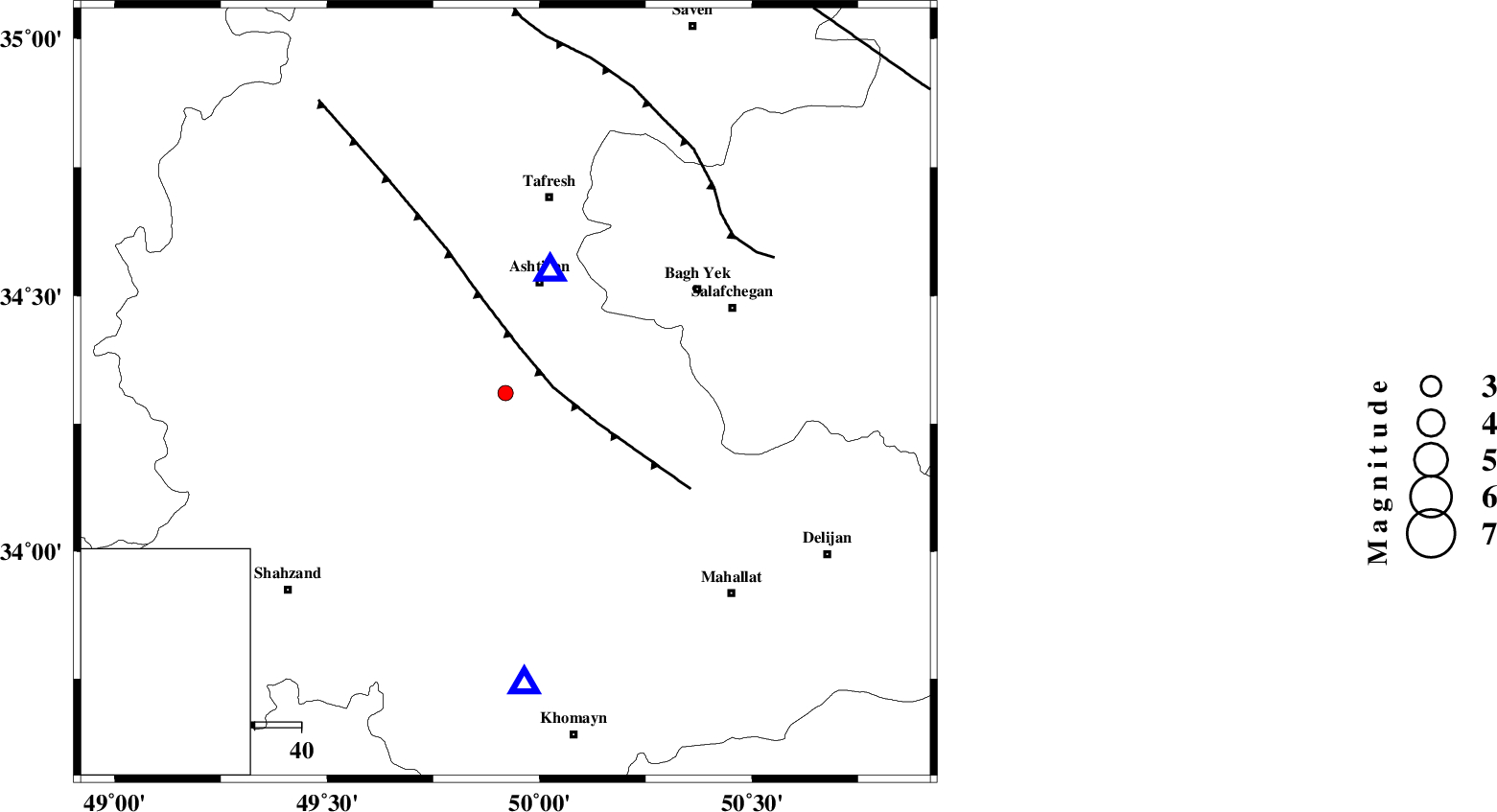
| Location | Lat:34.31 Lon: 49.92 |
| Region | Markazi Province, 25 km South of Ashtiyan |
Nearest Cities |
|
| 5 km North of Davoodabad, Markazi Province | |
| 17 km North West of Ebrahimabad, Markazi Province | |
| 21 km North East of Ebakabad, Markazi Province | |
| 25 km South of Ashtiyan, Markazi Province | |
| 27 km West of Salehabad, Markazi Province | |
| Depth | 12 km |
| Agency | |
Faults within 150 km: |
|
| TAFRESH_F (Length: 117 km) , Distance to epicenter: 10 km | |
| INDES_F (Length: 98 km) , Distance to epicenter: 60 km | |
| KUSHK_E_NOSRAT_F (Length: 230 km) , Distance to epicenter: 104 km | |
| Number of Phases | 5 |
| RMS | 0 |
| Number of Stations | 3 |
| Error in Latitude | >1.6 km |
| Error in Longitude | 4.8 km |
| Error in Depth | 7.7 km |
Download waveform in seisan format
to download seisan software Click here
to access information about IIEES stations Click here
Amplitude | ||||||||
| UID | Agency | Station | Component | Amplitude | Period | Arrival Time | Proccessing Time | Signal Clip |
| 82046 | IIEES | ASAO | E | 499.5 | 0.36 | 2012-02-26 13:32:02 | 2012-02-26 12:40:00 | n |
| 82047 | IIEES | GHVR | N | 61.3 | 0.72 | 2012-02-26 13:32:32 | 2012-02-26 12:40:00 | n |
Phase | ||||||||||||
| Agency | Station | Component | Phase Type | Phase Quality | First Motion | Observed Arrival Time | Time Residual | Loc. Flag | Input Weight | Distance | Azimuth | |
| IIEES | ASAO | Z | Pg | E | 2012-02-26 13:31:58 | -0.02 | y | 28 | 21 | |||
| IIEES | ASAO | N | Sg | E | 2012-02-26 13:32:02 | 0.01 | y | 28 | 21 | |||
| IIEES | KHMZ | Z | Pg | E | 2012-02-26 13:32:04 | 0.02 | y | 63.7 | 176 | |||
| IIEES | KHMZ | N | Sg | E | 2012-02-26 13:32:12 | -0.01 | y | 63.7 | 176 | |||
| IIEES | GHVR | Z | Pg | E | 2012-02-26 13:32:14 | 0 | y | 124 | 81 | |||