
Magnitude |
:3.4 |
| Date & Time (UTC) | 2012-02-17 03:49:20.8 |
| Date & Time (Local) | 1390/11/28 07:19:20.8 |
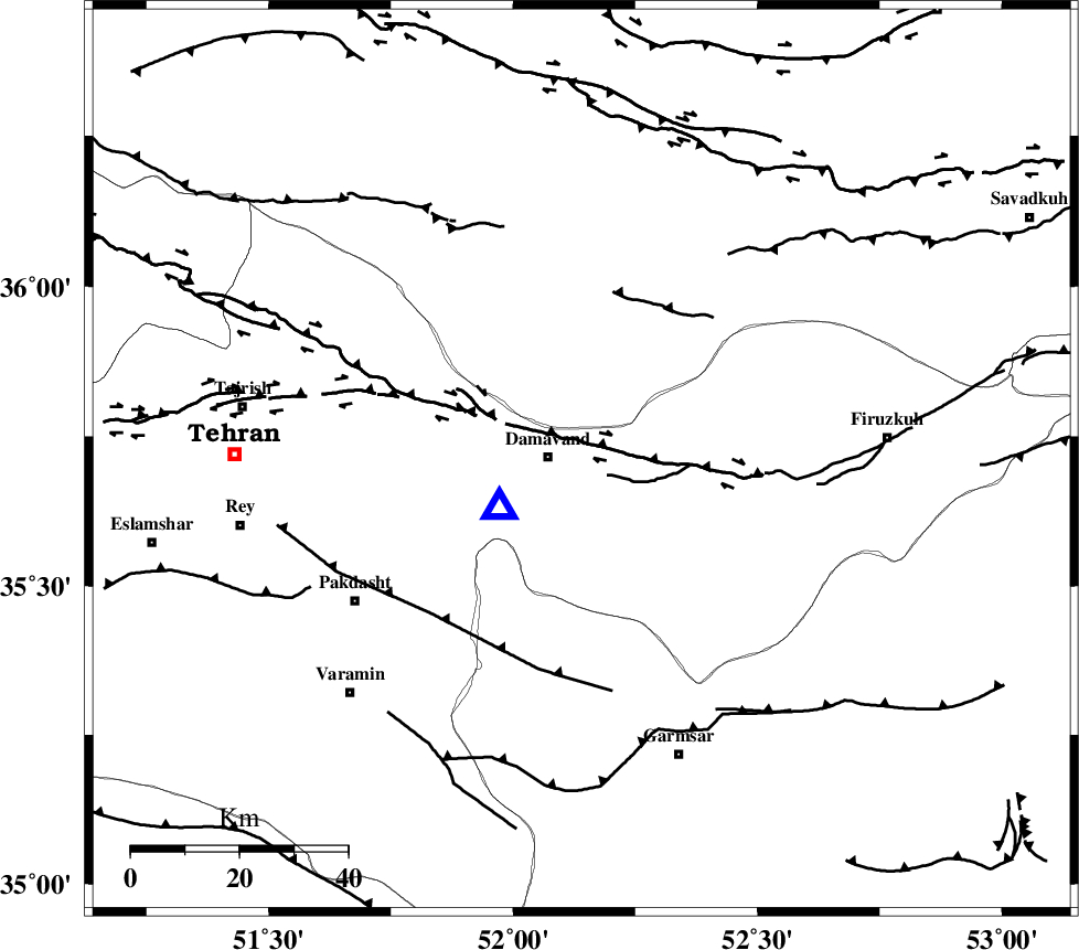
| Location | Lat:35.71 Lon: 52.14 |
| Region | Tehran Province, 6 km Damavand |
Nearest Cities |
|
| 6 km of Damavand, Tehran Province | |
| 11 km North of Mara, Tehran Province | |
| 13 km North East of Ab sard, Tehran Province | |
| 14 km East of Abali, Tehran Province | |
| 17 km North West of Sarbandan, Tehran Province | |
| Depth | 14 km |
| Agency | |
Faults within 150 km: |
|
| MOSHA_F (Length: 234 km) , Distance to epicenter: 9 km | |
| N_TEHRAN_F4 (Length: 115 km) , Distance to epicenter: 35 km | |
| EYVANEKEY_F (Length: 74 km) , Distance to epicenter: 40 km | |
| Number of Phases | 7 |
| RMS | 0.1 |
| Number of Stations | 6 |
| Error in Latitude | >2.1 km |
| Error in Longitude | 3.3 km |
| Error in Depth | 4 km |
Download waveform in seisan format
to download seisan software Click here
to access information about IIEES stations Click here
Amplitude | ||||||||
| UID | Agency | Station | Component | Amplitude | Period | Arrival Time | Proccessing Time | Signal Clip |
| 81903 | IIEES | GHVR | N | 499.8 | 0.36 | 2012-02-17 03:50:13 | 2012-02-17 03:16:00 | n |
| 81904 | IIEES | GHVR | E | 587.1 | 0.36 | 2012-02-17 03:50:16 | 2012-02-17 03:16:00 | n |
Phase | ||||||||||||
| Agency | Station | Component | Phase Type | Phase Quality | First Motion | Observed Arrival Time | Time Residual | Loc. Flag | Input Weight | Distance | Azimuth | |
| IIEES | CHTH | Z | Pg | E | 2012-02-17 03:49:36 | -0.15 | y | 94.1 | 284 | |||
| IIEES | THKV | Z | Pg | E | 2012-02-17 03:49:40 | 0.11 | y | 116 | 282 | |||
| IIEES | GHVR | Z | Pg | E | 2012-02-17 03:49:47 | 0.01 | y | 159 | 211 | |||
| IIEES | ASAO | Z | Pn | E | 2012-02-17 03:49:57 | 0.04 | y | 232 | 237 | |||
| IIEES | ASAO | E | Sg | E | 2012-02-17 03:50:26 | -0.04 | y | 232 | 237 | |||
| IIEES | KHMZ | Z | Pn | E | 2012-02-17 03:50:05 | 0.15 | y | 296 | 223 | |||
| IIEES | NASN | Z | Pn | E | 2012-02-17 03:50:09 | -0.13 | y | 329 | 169 | |||