
Magnitude |
:3 |
| Date & Time (UTC) | 2012-02-11 01:23:30.2 |
| Date & Time (Local) | 1390/11/22 04:53:30.2 |
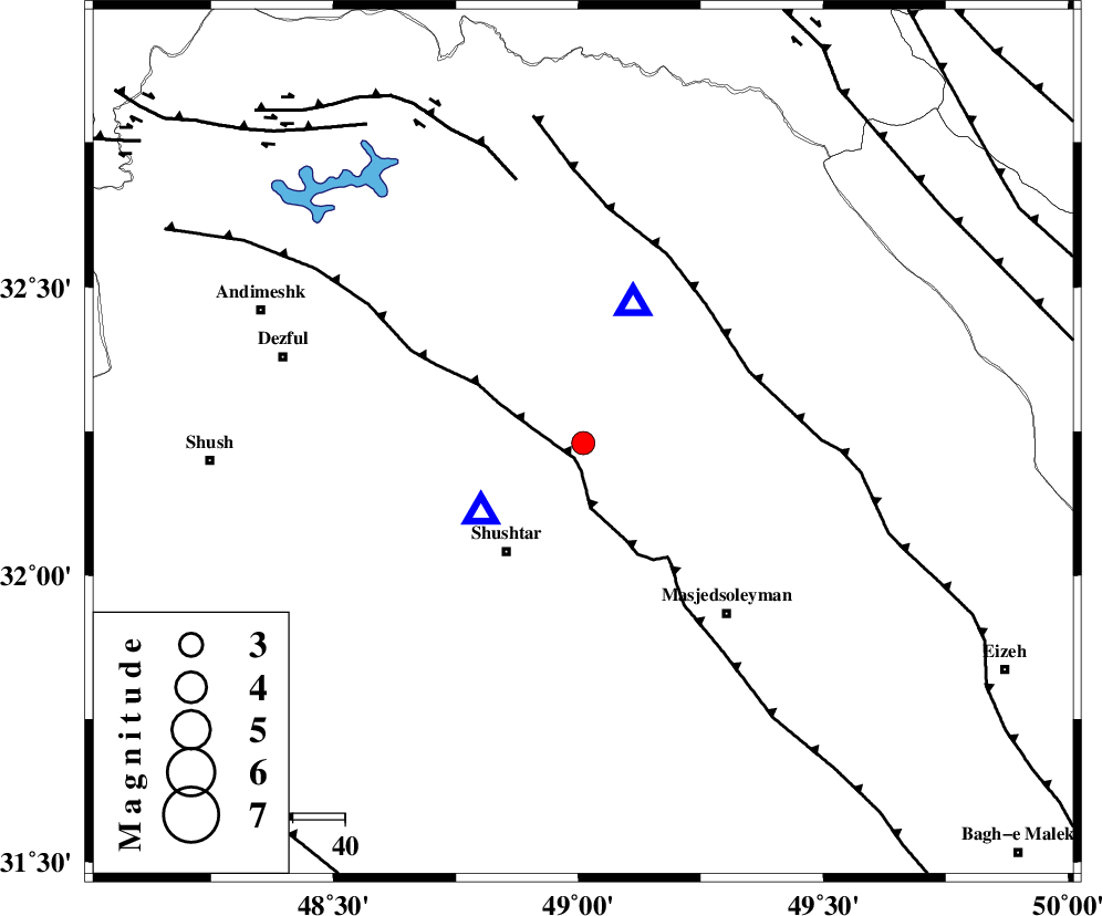
| Location | Lat:32.23 Lon: 49.01 |
| Region | Khoozestan Province, 20 km South of Lali |
Nearest Cities |
|
| 12 km West of Jaefarabad, Khoozestan Province | |
| 12 km North of Haft shahidan, Khoozestan Province | |
| 15 km North East of Samaleh, Khoozestan Province | |
| 19 km East of Gatvand, Khoozestan Province | |
| 20 km South of Lali, Khoozestan Province | |
| Depth | 16 km |
| Agency | |
Faults within 150 km: |
|
| DEZFUL_EMBAYMENT (Length: 228 km) , Distance to epicenter: 3 km | |
| MFF2 (Length: 205 km) , Distance to epicenter: 35 km | |
| BALARUD_F_Z2 (Length: 58 km) , Distance to epicenter: 52 km | |
| Number of Phases | 5 |
| RMS | 0.3 |
| Number of Stations | 4 |
| Error in Latitude | >4.9 km |
| Error in Longitude | 8.6 km |
| Error in Depth | 6.1 km |
Download waveform in seisan format
to download seisan software Click here
to access information about IIEES stations Click here
Amplitude | ||||||||
| UID | Agency | Station | Component | Amplitude | Period | Arrival Time | Proccessing Time | Signal Clip |
| 81849 | IIEES | SHGR | E | 4294.4 | 0.68 | 2012-02-11 01:23:43 | 2012-02-11 12:38:00 | n |
| 81850 | IIEES | SHGR | N | 2044.6 | 0.4 | 2012-02-11 01:23:47 | 2012-02-11 12:38:00 | n |
| 81851 | IIEES | KHMZ | E | 250 | 0.84 | 2012-02-11 01:24:28 | 2012-02-11 12:38:00 | n |
| 81852 | IIEES | ASAO | N | 67.7 | 0.56 | 2012-02-11 01:24:54 | 2012-02-11 12:38:00 | n |
| 81853 | IIEES | ASAO | E | 59 | 0.52 | 2012-02-11 01:24:56 | 2012-02-11 12:38:00 | n |
Phase | ||||||||||||
| Agency | Station | Component | Phase Type | Phase Quality | First Motion | Observed Arrival Time | Time Residual | Loc. Flag | Input Weight | Distance | Azimuth | |
| IIEES | SHGR | Z | Pg | E | 2012-02-11 01:23:35 | -0.01 | y | 24 | 236 | |||
| IIEES | KHMZ | Z | Pn | E | 2012-02-11 01:24:00 | -0.43 | y | 190 | 28 | |||
| IIEES | KHMZ | N | Sg | E | 2012-02-11 01:24:24 | 0.01 | y | 190 | 28 | |||
| IIEES | ASAO | Z | Pn | E | 2012-02-11 01:24:12 | 0.38 | y | 274 | 20 | |||
| IIEES | NASN | Z | Pn | E | 2012-02-11 01:24:23 | 0.07 | y | 362 | 79 | |||