
Magnitude |
:1.3 |
| Date & Time (UTC) | 2012-02-09 04:24:35.4 |
| Date & Time (Local) | 1390/11/20 07:54:35.4 |
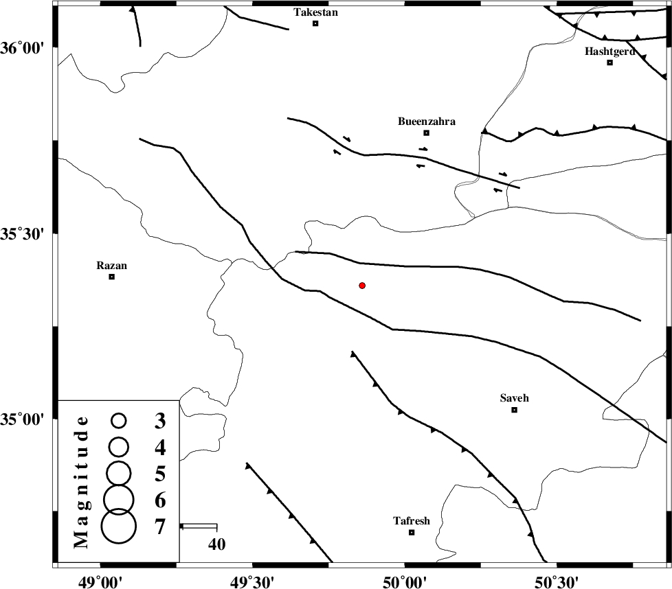
| Location | Lat:35.36 Lon: 49.86 |
| Region | Markazi Province, 49 km South-West of Buinzara |
Nearest Cities |
|
| 6 km of Duzaj, Markazi Province | |
| 9 km North of Razegian, Markazi Province | |
| 28 km North of Gharqabad, Markazi Province | |
| 29 km North East of Nobaran, Markazi Province | |
| 32 km North East of Yatan, Markazi Province | |
| Depth | 15 km |
| Agency | |
Faults within 150 km: |
|
| S_PARANDAK_F (Length: 116 km) , Distance to epicenter: 7 km | |
| KUSHK_E_NOSRAT_F (Length: 230 km) , Distance to epicenter: 10 km | |
| INDES_F (Length: 98 km) , Distance to epicenter: 20 km | |
| Number of Phases | 5 |
| RMS | 0.4 |
| Number of Stations | 4 |
| Error in Latitude | >8.7 km |
| Error in Longitude | 15.2 km |
| Error in Depth | 12.8 km |
Download waveform in seisan format
to download seisan software Click here
to access information about IIEES stations Click here
Amplitude | ||||||||
| UID | Agency | Station | Component | Amplitude | Period | Arrival Time | Proccessing Time | Signal Clip |
| 81809 | IIEES | ASAO | E | 5.3 | 0.26 | 2012-02-09 04:25:13 | 2012-02-09 04:03:00 | n |
| 81810 | IIEES | ASAO | N | 8.5 | 0.19 | 2012-02-09 04:25:14 | 2012-02-09 04:03:00 | n |
| 81811 | IIEES | GHVR | E | 8.9 | 0.37 | 2012-02-09 04:25:30 | 2012-02-09 04:03:00 | n |
| 81812 | IIEES | GHVR | N | 11.1 | 0.52 | 2012-02-09 04:25:38 | 2012-02-09 04:03:00 | n |
| 81813 | IIEES | KHMZ | E | 2.6 | 0.44 | 2012-02-09 04:25:40 | 2012-02-09 04:03:00 | n |
Phase | ||||||||||||
| Agency | Station | Component | Phase Type | Phase Quality | First Motion | Observed Arrival Time | Time Residual | Loc. Flag | Input Weight | Distance | Azimuth | |
| IIEES | ASAO | Z | P | E | 2012-02-09 04:24:51 | -0.02 | y | 91.5 | 171 | |||
| IIEES | CHTH | Z | P | E | 2012-02-09 04:24:57 | 0.41 | y | 130 | 62 | |||
| IIEES | CHTH | E | Sg | E | 2012-02-09 04:25:12 | -0.41 | y | 130 | 62 | |||
| IIEES | GHVR | Z | P | E | 2012-02-09 04:25:01 | 0.39 | y | 160 | 127 | |||
| IIEES | KHMZ | Z | P | E | 2012-02-09 04:25:04 | -0.37 | y | 180 | 177 | |||