
Magnitude |
:2.7 |
| Date & Time (UTC) | 2012-01-27 13:52:14.1 |
| Date & Time (Local) | 1390/11/7 17:22:14.1 |
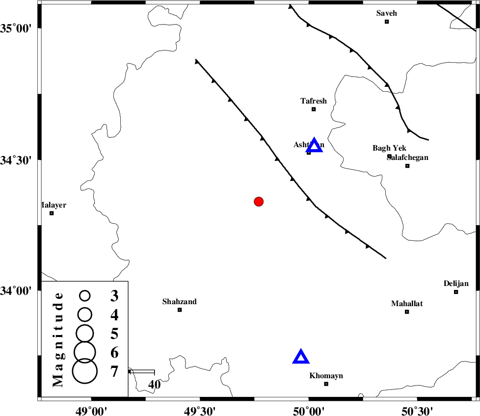
| Location | Lat:34.34 Lon: 49.77 |
| Region | Markazi Province, 29 km North of Arak |
Nearest Cities |
|
| 10 km North of Davoodabad, Markazi Province | |
| 11 km North of Ebakabad, Markazi Province | |
| 20 km South of Farmahin, Markazi Province | |
| 25 km East of Saruq, Markazi Province | |
| 26 km North East of Marzijaran, Markazi Province | |
| Depth | 14 km |
| Agency | |
Faults within 150 km: |
|
| TAFRESH_F (Length: 117 km) , Distance to epicenter: 18 km | |
| INDES_F (Length: 98 km) , Distance to epicenter: 70 km | |
| KUSHK_E_NOSRAT_F (Length: 230 km) , Distance to epicenter: 102 km | |
| Number of Phases | 4 |
| RMS | 0.1 |
| Number of Stations | 3 |
| Error in Latitude | >2.4 km |
| Error in Longitude | 3.3 km |
| Error in Depth | 8.9 km |
Download waveform in seisan format
to download seisan software Click here
to access information about IIEES stations Click here
Amplitude | ||||||||
| UID | Agency | Station | Component | Amplitude | Period | Arrival Time | Proccessing Time | Signal Clip |
| 81619 | IIEES | ASAO | E | 1003.9 | 0.44 | 2012-01-27 13:52:25 | 2012-01-27 01:05:00 | n |
| 81620 | IIEES | KHMZ | E | 411.9 | 0.16 | 2012-01-27 13:52:34 | 2012-01-27 01:05:00 | n |
| 81621 | IIEES | GHVR | N | 125.4 | 0.36 | 2012-01-27 13:52:54 | 2012-01-27 01:05:00 | n |
| 81622 | IIEES | GHVR | E | 153.1 | 0.36 | 2012-01-27 13:52:55 | 2012-01-27 01:05:00 | n |
Phase | ||||||||||||
| Agency | Station | Component | Phase Type | Phase Quality | First Motion | Observed Arrival Time | Time Residual | Loc. Flag | Input Weight | Distance | Azimuth | |
| IIEES | ASAO | Z | P | E | 2012-01-27 13:52:20 | -0.05 | y | 33.4 | 45 | |||
| IIEES | KHMZ | Z | P | E | 2012-01-27 13:52:26 | -0.03 | y | 68.4 | 165 | |||
| IIEES | GHVR | Z | P | E | 2012-01-27 13:52:36 | 0.12 | y | 137 | 83 | |||
| IIEES | GHVR | N | Sg | E | 2012-01-27 13:52:53 | -0.04 | y | 137 | 83 | |||