
Magnitude |
:3.6 |
| Date & Time (UTC) | 2012-01-05 17:49:11.2 |
| Date & Time (Local) | 1390/10/15 21:19:11.2 |
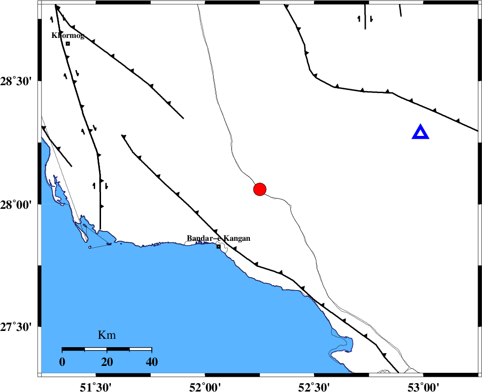
| Location | Lat:28.06 Lon: 52.25 |
| Region | Bushehr Province, 26 km North of Jam |
Nearest Cities |
|
| 11 km of Dolatabad, Fars Province | |
| 18 km North East of Riz, Bushehr Province | |
| 26 km North of Jam, Bushehr Province | |
| 32 km North East of Bandar-e kangan, Bushehr Province | |
| 45 km North of Bandar-e taheri, Bushehr Province | |
| Depth | 42 km |
| Agency | |
Faults within 150 km: |
|
| MFF3 (Length: 292 km) , Distance to epicenter: 29 km | |
| MFF5 (Length: 74 km) , Distance to epicenter: 47 km | |
| QIR_F (Length: 130 km) , Distance to epicenter: 56 km | |
| Number of Phases | 6 |
| RMS | 0.1 |
| Number of Stations | 6 |
| Error in Latitude | >4.2 km |
| Error in Longitude | 2.6 km |
| Error in Depth | 2.1 km |
Download waveform in seisan format
to download seisan software Click here
to access information about IIEES stations Click here
Amplitude | ||||||||
| UID | Agency | Station | Component | Amplitude | Period | Arrival Time | Proccessing Time | Signal Clip |
| 81256 | IIEES | GHIR | N | 2038.4 | 0.44 | 2012-01-05 17:49:47 | 2012-01-05 05:14:00 | n |
| 81257 | IIEES | AHRM | N | 1322.4 | 0.4 | 2012-01-05 17:49:53 | 2012-01-05 05:14:00 | n |
Phase | ||||||||||||
| Agency | Station | Component | Phase Type | Phase Quality | First Motion | Observed Arrival Time | Time Residual | Loc. Flag | Input Weight | Distance | Azimuth | |
| IIEES | GHIR | Z | Pg | E | 2012-01-05 17:49:25 | 0.01 | y | 77 | 71 | |||
| IIEES | AHRM | Z | Pg | E | 2012-01-05 17:49:32 | -0.01 | y | 129 | 314 | |||
| IIEES | BNDS | Z | Pn | E | 2012-01-05 17:50:05 | -0.01 | y | 394 | 100 | |||
| IIEES | NASN | Z | Pn | E | 2012-01-05 17:50:22 | -0.1 | y | 528 | 6 | |||
| IIEES | KHMZ | Z | Pn | E | 2012-01-05 17:50:39 | 0.1 | y | 666 | 341 | |||
| IIEES | TABS | N | Pn | E | 2012-01-05 17:50:52 | 0.06 | y | 775 | 36 | |||