
Magnitude |
:3.2 |
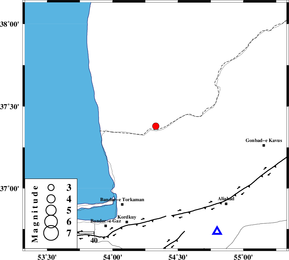
| Date & Time (UTC) | 2012-01-05 05:01:01.0 |
| Date & Time (Local) | 1390/10/15 08:31:01.0 |
| Location | Lat:37.38 Lon: 54.33 |
| Region | Turkmenistan, 42 km North-West of Aq Qaleh |
Nearest Cities |
|
| 36 km West of Enchehborun, Golestan Province | |
| 38 km North East of Gomishtappeh, Golestan Province | |
| 42 km North East of Banavar, Golestan Province | |
| 42 km North West of Aq Qaleh, Golestan Province | |
| 44 km North West of Qanqarmeh, Golestan Province | |
| Depth | 26 km |
| Agency | |
Faults within 150 km: |
|
| KHAZAR_F (Length: 523 km) , Distance to epicenter: 61 km | |
| N_ALBORZ_F (Length: 360 km) , Distance to epicenter: 86 km | |
| SHAVAR_F (Length: 87 km) , Distance to epicenter: 91 km | |
| Number of Phases | 7 |
| RMS | 0.1 |
| Number of Stations | 5 |
| Error in Latitude | >2.1 km |
| Error in Longitude | 2.5 km |
| Error in Depth | 4.9 km |
Download waveform in seisan format
to download seisan software Click here
to access information about IIEES stations Click here
Amplitude | ||||||||
| UID | Agency | Station | Component | Amplitude | Period | Arrival Time | Proccessing Time | Signal Clip |
| 81248 | IIEES | MRVT | N | 329.1 | 0.28 | 2012-01-05 05:01:50 | 2012-01-05 04:26:00 | n |
| 81249 | IIEES | MRVT | E | 364.8 | 0.48 | 2012-01-05 05:01:50 | 2012-01-05 04:26:00 | n |
Phase | ||||||||||||
| Agency | Station | Component | Phase Type | Phase Quality | First Motion | Observed Arrival Time | Time Residual | Loc. Flag | Input Weight | Distance | Azimuth | |
| IIEES | MRVT | Z | Pg | E | 2012-01-05 05:01:27 | 0.1 | y | 159 | 78 | |||
| IIEES | MRVT | E | Sg | E | 2012-01-05 05:01:45 | 0.01 | y | 159 | 78 | |||
| IIEES | SHRO | Z | Pn | E | 2012-01-05 05:01:34 | 0.21 | y | 214 | 135 | |||
| IIEES | SHRO | E | Sg | E | 2012-01-05 05:02:00 | -0.11 | y | 214 | 135 | |||
| IIEES | BJRD | Z | Pn | E | 2012-01-05 05:01:41 | -0.18 | y | 275 | 82 | |||
| IIEES | CHTH | Z | Pn | E | 2012-01-05 05:01:48 | 0.09 | y | 329 | 241 | |||
| IIEES | ZNJK | Z | Pn | E | 2012-01-05 05:02:10 | -0.18 | y | 508 | 263 | |||