
Magnitude |
:2.5 |
| Date & Time (UTC) | 2012-01-04 09:11:00.2 |
| Date & Time (Local) | 1390/10/14 12:41:00.2 |
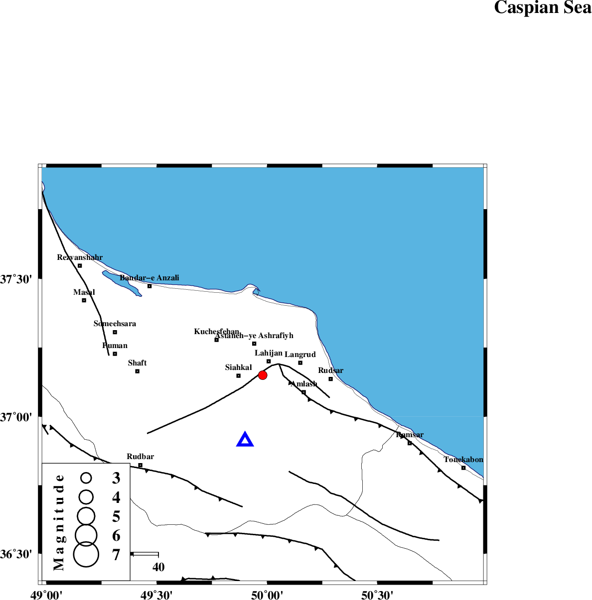
| Location | Lat:37.15 Lon: 49.98 |
| Region | Gilan Province, 7 km Lahijan |
Nearest Cities |
|
| 1 km of Satl-e sarahandan, Gilan Province | |
| 4 km of Bazkiagorab, Gilan Province | |
| 6 km of Lahijan, Gilan Province | |
| 8 km North of Chinijan, Gilan Province | |
| 10 km North East of Siahkal, Gilan Province | |
| Depth | 15 km |
| Agency | |
Faults within 150 km: |
|
| LAHIJAN_F (Length: 92 km) , Distance to epicenter: 2 km | |
| KHAZAR_F (Length: 523 km) , Distance to epicenter: 8 km | |
| BONAN_F (Length: 74 km) , Distance to epicenter: 40 km | |
| Number of Phases | 5 |
| RMS | 0.4 |
| Number of Stations | 5 |
| Error in Latitude | >7.4 km |
| Error in Longitude | 7.3 km |
| Error in Depth | 7.9 km |
Download waveform in seisan format
to download seisan software Click here
to access information about IIEES stations Click here
Amplitude | ||||||||
| UID | Agency | Station | Component | Amplitude | Period | Arrival Time | Proccessing Time | Signal Clip |
| 81243 | IIEES | ZNJK | N | 230.1 | 0.4 | 2012-01-04 09:11:44 | 2012-01-04 08:32:00 | n |
| 81244 | IIEES | CHTH | E | 64.3 | 0.18 | 2012-01-04 09:11:50 | 2012-01-04 08:32:00 | n |
| 81245 | IIEES | ASAO | N | 21.8 | 0.28 | 2012-01-04 09:12:22 | 2012-01-04 08:32:00 | n |
| 81246 | IIEES | SNGE | E | 13.2 | 0.42 | 2012-01-04 09:12:35 | 2012-01-04 08:32:00 | n |
| 81247 | IIEES | SNGE | N | 10.8 | 0.47 | 2012-01-04 09:12:37 | 2012-01-04 08:32:00 | n |
Phase | ||||||||||||
| Agency | Station | Component | Phase Type | Phase Quality | First Motion | Observed Arrival Time | Time Residual | Loc. Flag | Input Weight | Distance | Azimuth | |
| IIEES | ZNJK | Z | Pg | E | 2012-01-04 09:11:21 | -0.58 | y | 127 | 246 | |||
| IIEES | CHTH | Z | Pg | E | 2012-01-04 09:11:28 | -0.3 | y | 171 | 143 | |||
| IIEES | GRMI | Z | Pn | E | 2012-01-04 09:11:40 | 0.05 | y | 260 | 316 | |||
| IIEES | ASAO | Z | Pn | E | 2012-01-04 09:11:44 | 0.28 | y | 288 | 179 | |||
| IIEES | SNGE | Z | Pn | E | 2012-01-04 09:11:49 | 0.64 | y | 329 | 227 | |||