
Magnitude |
:3.4 |
| Date & Time (UTC) | 2011-12-23 22:43:26.8 |
| Date & Time (Local) | 1390/10/3 02:13:26.8 |
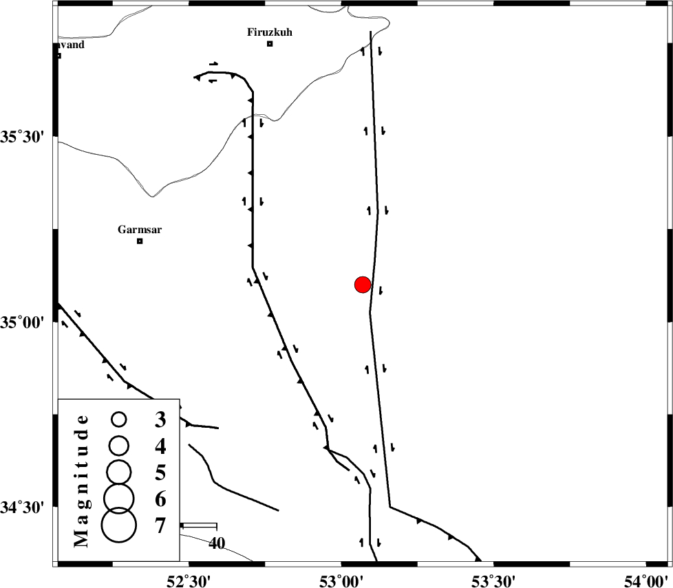
| Location | Lat:35.1 Lon: 53.07 |
| Region | Semnan Province, 60 km South-West of Semnan |
Nearest Cities |
|
| 34 km South of Lasjerd, Semnan Province | |
| 42 km South West of Sorkheh, Semnan Province | |
| 49 km South East of Kohanabad, Semnan Province | |
| 52 km South East of Aradan, Semnan Province | |
| 56 km South of Aftar, Semnan Province | |
| Depth | 32 km |
| Agency | |
Faults within 150 km: |
|
| KUH_E_GACHAB_F1 (Length: 53 km) , Distance to epicenter: 1 km | |
| KUH_E_GACHAB_F2 (Length: 31 km) , Distance to epicenter: 17 km | |
| KUH_E_GUGERD_F (Length: 73 km) , Distance to epicenter: 19 km | |
| Number of Phases | 8 |
| RMS | 0.2 |
| Number of Stations | 6 |
| Error in Latitude | >2.3 km |
| Error in Longitude | 3.1 km |
| Error in Depth | 5.4 km |
Download waveform in seisan format
to download seisan software Click here
to access information about IIEES stations Click here
Amplitude | ||||||||
| UID | Agency | Station | Component | Amplitude | Period | Arrival Time | Proccessing Time | Signal Clip |
| 81090 | IIEES | GHVR | E | 442.2 | 0.4 | 2011-12-23 22:44:24 | 2011-12-23 09:55:00 | n |
| 81091 | IIEES | CHTH | E | 347.9 | 0.56 | 2011-12-23 22:44:24 | 2011-12-23 09:55:00 | n |
| 81092 | IIEES | THKV | E | 370 | 0.44 | 2011-12-23 22:44:31 | 2011-12-23 09:55:00 | n |
Phase | ||||||||||||
| Agency | Station | Component | Phase Type | Phase Quality | First Motion | Observed Arrival Time | Time Residual | Loc. Flag | Input Weight | Distance | Azimuth | |
| IIEES | GHVR | Z | Pn | E | 2011-12-23 22:43:55 | -0.18 | y | 180 | 248 | |||
| IIEES | GHVR | N | Sg | E | 2011-12-23 22:44:17 | -0.02 | y | 180 | 248 | |||
| IIEES | CHTH | Z | Pn | E | 2011-12-23 22:43:57 | -0.21 | y | 198 | 298 | |||
| IIEES | CHTH | E | Sg | E | 2011-12-23 22:44:22 | 0.02 | y | 198 | 298 | |||
| IIEES | THKV | Z | Pn | E | 2011-12-23 22:44:00 | 0.02 | y | 218 | 295 | |||
| IIEES | NASN | Z | Pn | E | 2011-12-23 22:44:04 | -0.06 | y | 256 | 185 | |||
| IIEES | SHRO | N | Pn | E | 2011-12-23 22:44:08 | 0.04 | y | 285 | 68 | |||
| IIEES | ASAO | Z | Pn | E | 2011-12-23 22:44:08 | 0.42 | y | 285 | 258 | |||