
Magnitude |
:2.8 |
| Date & Time (UTC) | 2011-12-23 16:49:23.6 |
| Date & Time (Local) | 1390/10/2 20:19:23.6 |
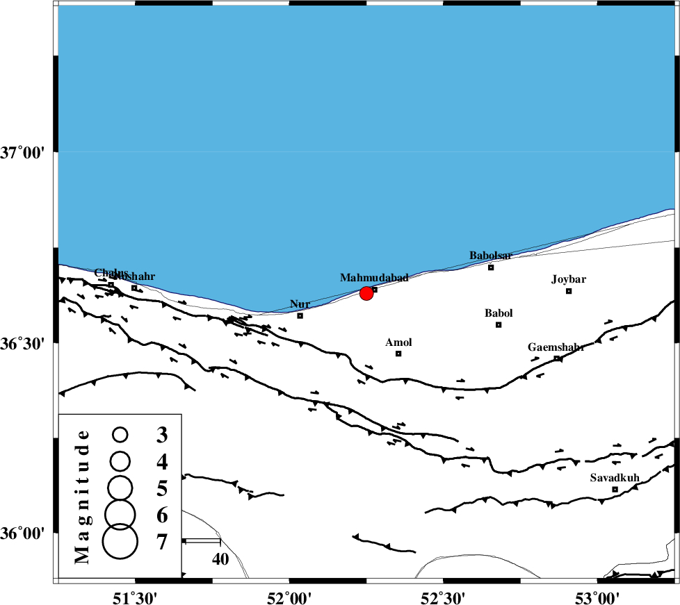
| Location | Lat:36.63 Lon: 52.25 |
| Region | Mazandaran Province, 2 km Mahmud Abad |
Nearest Cities |
|
| 2 km North of Azadmun, Mazandaran Province | |
| 3 km of Mahmud Abad, Mazandaran Province | |
| 10 km West of Bisheh kola, Mazandaran Province | |
| 11 km North East of Eizdeh, Mazandaran Province | |
| 20 km West of Kargard-e mahalleh, Mazandaran Province | |
| Depth | 17 km |
| Agency | |
Faults within 150 km: |
|
| KHAZAR_F (Length: 523 km) , Distance to epicenter: 20 km | |
| N_ALBORZ_F (Length: 360 km) , Distance to epicenter: 35 km | |
| KOJOOR (Length: 75 km) , Distance to epicenter: 57 km | |
| Number of Phases | 7 |
| RMS | 0.1 |
| Number of Stations | 6 |
| Error in Latitude | >3.1 km |
| Error in Longitude | 2.6 km |
| Error in Depth | 3.9 km |
Download waveform in seisan format
to download seisan software Click here
to access information about IIEES stations Click here
Amplitude | ||||||||
| UID | Agency | Station | Component | Amplitude | Period | Arrival Time | Proccessing Time | Signal Clip |
| 81084 | IIEES | THKV | E | 151 | 0.4 | 2011-12-23 16:50:14 | 2011-12-23 04:51:00 | n |
Phase | ||||||||||||
| Agency | Station | Component | Phase Type | Phase Quality | First Motion | Observed Arrival Time | Time Residual | Loc. Flag | Input Weight | Distance | Azimuth | |
| IIEES | CHTH | Z | Pg | E | 2011-12-23 16:49:45 | -0.11 | y | 129 | 232 | |||
| IIEES | THKV | Z | Pg | E | 2011-12-23 16:49:48 | 0.15 | y | 147 | 238 | |||
| IIEES | ASAO | Z | Pn | E | 2011-12-23 16:50:09 | 0.14 | y | 307 | 222 | |||
| IIEES | ASAO | E | Sg | E | 2011-12-23 16:50:50 | -0.04 | y | 307 | 222 | |||
| IIEES | ZNJK | Z | P | E | 2011-12-23 16:50:10 | -0.07 | y | 319 | 272 | |||
| IIEES | SHRO | Z | P | E | 2011-12-23 16:50:13 | -0.01 | y | 345 | 101 | |||
| IIEES | KHMZ | Z | P | E | 2011-12-23 16:50:18 | -0.07 | y | 383 | 214 | |||