
Magnitude |
:3.4 |
| Date & Time (UTC) | 2011-12-09 06:42:12.5 |
| Date & Time (Local) | 1390/9/18 10:12:12.5 |
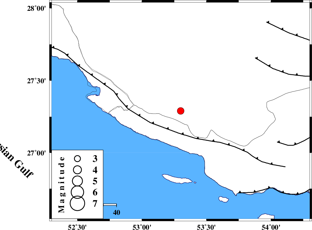
| Location | Lat:27.29 Lon: 53.3 |
| Region | Fars Province, 13 km East of Lamerd |
Nearest Cities |
|
| 14 km East of Lamerd, Fars Province | |
| 26 km South West of Beyram, Fars Province | |
| 32 km North West of Ashkenan, Fars Province | |
| 36 km South East of Khoozi, Fars Province | |
| 40 km South West of Fedagh, Fars Province | |
| Depth | 14 km |
| Agency | |
Faults within 150 km: |
|
| MFF3 (Length: 292 km) , Distance to epicenter: 17 km | |
| LAR_F (Length: 99 km) , Distance to epicenter: 70 km | |
| ZFF1 (Length: 165 km) , Distance to epicenter: 77 km | |
| Number of Phases | 5 |
| RMS | 0.1 |
| Number of Stations | 4 |
| Error in Latitude | >4 km |
| Error in Longitude | 2.8 km |
| Error in Depth | 6.3 km |
Download waveform in seisan format
to download seisan software Click here
to access information about IIEES stations Click here
Amplitude | ||||||||
| UID | Agency | Station | Component | Amplitude | Period | Arrival Time | Proccessing Time | Signal Clip |
| 80940 | IIEES | GHIR | E | 2173.1 | 0.44 | 2011-12-09 06:42:49 | 2011-12-09 06:22:00 | n |
| 80941 | IIEES | GHIR | N | 931.9 | 0.52 | 2011-12-09 06:42:53 | 2011-12-09 06:22:00 | n |
| 80942 | IIEES | AHRM | N | 112.7 | 0.64 | 2011-12-09 06:43:42 | 2011-12-09 06:22:00 | n |
| 80943 | IIEES | KRBR | E | 31.8 | 0.76 | 2011-12-09 06:44:15 | 2011-12-09 06:22:00 | n |
Phase | ||||||||||||
| Agency | Station | Component | Phase Type | Phase Quality | First Motion | Observed Arrival Time | Time Residual | Loc. Flag | Input Weight | Distance | Azimuth | |
| IIEES | GHIR | Z | Pg | E | 2011-12-09 06:42:31 | -0.11 | y | 114 | 345 | |||
| IIEES | GHIR | E | Sg | E | 2011-12-09 06:42:45 | 0.04 | y | 114 | 345 | |||
| IIEES | AHRM | Z | P | E | 2011-12-09 06:42:52 | 0.05 | y | 263 | 312 | |||
| IIEES | BNDS | Z | P | E | 2011-12-09 06:42:55 | -0.02 | y | 285 | 87 | |||
| IIEES | KRBR | Z | P | E | 2011-12-09 06:43:16 | 0.06 | y | 451 | 48 | |||