
Magnitude |
:2.8 |
| Date & Time (UTC) | 2011-11-17 08:10:17.5 |
| Date & Time (Local) | 1390/8/26 11:40:17.5 |
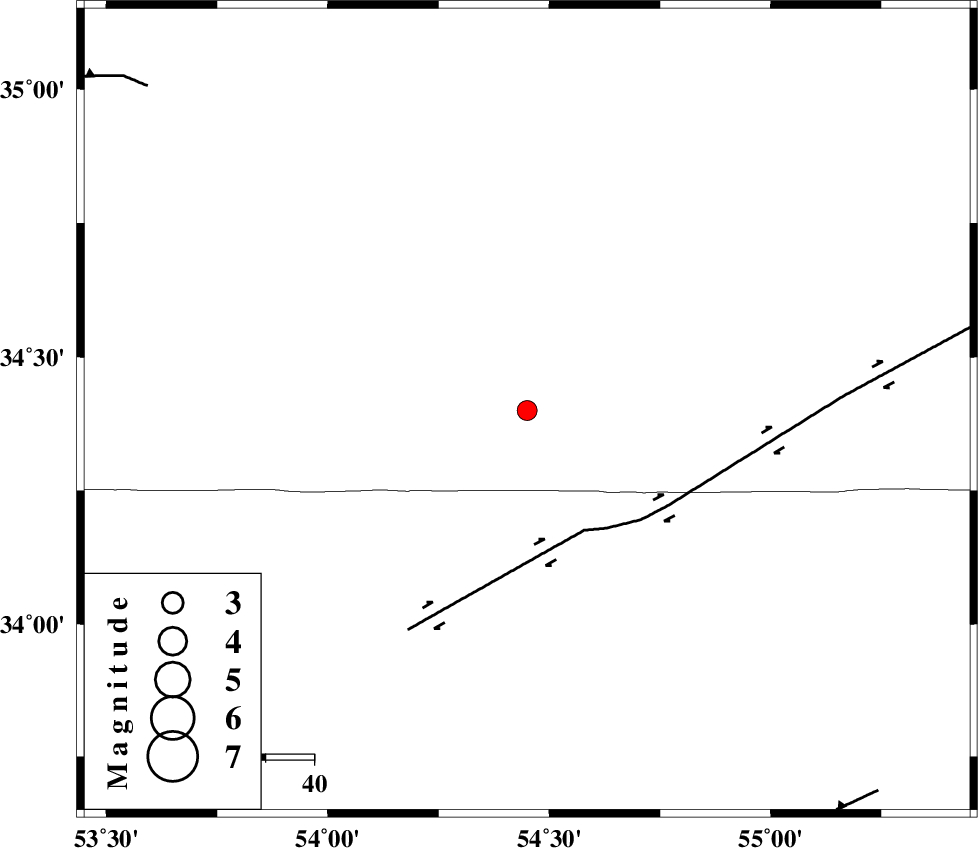
| Location | Lat:34.4 Lon: 54.45 |
| Region | Semnan Province, 196 km South of Damghan |
Nearest Cities |
|
| 40 km North of Jondaq, Esfahan Province | |
| 77 km North West of Farrokhi, Esfahan Province | |
| 87 km North of Chupanan, Esfahan Province | |
| 91 km North West of Khur, Esfahan Province | |
| 119 km North West of Mehranjan, Esfahan Province | |
| Depth | 46 km |
| Agency | |
Faults within 150 km: |
|
| DORUNEH_F (Length: 713 km) , Distance to epicenter: 28 km | |
| TORUD_F (Length: 136 km) , Distance to epicenter: 94 km | |
| KUH_E_GUGERD_F (Length: 73 km) , Distance to epicenter: 103 km | |
| Number of Phases | 7 |
| RMS | 0.5 |
| Number of Stations | 5 |
| Error in Latitude | >4.6 km |
| Error in Longitude | 3.1 km |
| Error in Depth | 7.7 km |
Download waveform in seisan format
to download seisan software Click here
to access information about IIEES stations Click here
Amplitude | ||||||||
| UID | Agency | Station | Component | Amplitude | Period | Arrival Time | Proccessing Time | Signal Clip |
| 80695 | IIEES | SHRO | E | 66.5 | 0.32 | 2011-11-17 08:11:23 | 2011-11-17 12:03:00 | n |
| 80696 | IIEES | SHRO | N | 90 | 0.52 | 2011-11-17 08:11:25 | 2011-11-17 12:03:00 | n |
| 80697 | IIEES | GHVR | N | 24.4 | 0.4 | 2011-11-17 08:11:41 | 2011-11-17 12:03:00 | n |
| 80698 | IIEES | GHVR | E | 65.1 | 0.48 | 2011-11-17 08:11:42 | 2011-11-17 12:03:00 | n |
Phase | ||||||||||||
| Agency | Station | Component | Phase Type | Phase Quality | First Motion | Observed Arrival Time | Time Residual | Loc. Flag | Input Weight | Distance | Azimuth | |
| IIEES | SHRO | Z | Pn | E | 2011-11-17 08:10:50 | 0.58 | y | 228 | 38 | |||
| IIEES | SHRO | N | Sg | E | 2011-11-17 08:11:20 | -0.68 | y | 228 | 38 | |||
| IIEES | NASN | Z | Pn | E | 2011-11-17 08:10:50 | -0.6 | y | 234 | 221 | |||
| IIEES | TABS | Z | Pn | E | 2011-11-17 08:10:54 | 0.07 | y | 261 | 108 | |||
| IIEES | TABS | N | Sg | E | 2011-11-17 08:11:30 | 0.31 | y | 261 | 108 | |||
| IIEES | GHVR | N | Sg | E | 2011-11-17 08:11:38 | -0.1 | y | 294 | 273 | |||
| IIEES | CHTH | E | Sg | E | 2011-11-17 08:11:53 | 0.48 | y | 346 | 300 | |||