
Magnitude |
:3.3 |
| Date & Time (UTC) | 2011-11-14 06:54:37.0 |
| Date & Time (Local) | 1390/8/23 10:24:37.0 |
| Location | Lat:35.55 Lon: 57.92 |
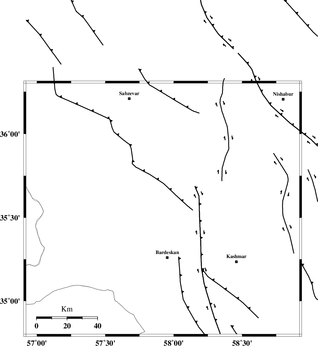
| Region | Khorasan(center) Province, 32 km North of Bardeskan |
Nearest Cities |
|
| 20 km North of Kabudan, Khorasan(center) Province | |
| 23 km South West of Ghaleh meidan, Khorasan(center) Province | |
| 31 km South East of Tondak, Khorasan(center) Province | |
| 32 km North of Bardeskan, Khorasan(center) Province | |
| 37 km West of Ondar, Khorasan(center) Province | |
| Depth | 43 km |
| Agency | |
Faults within 150 km: |
|
| BIJVARD_F (Length: 83 km) , Distance to epicenter: 13 km | |
| DORUNEH_F (Length: 713 km) , Distance to epicenter: 30 km | |
| BALHAR_F (Length: 117 km) , Distance to epicenter: 34 km | |
| Number of Phases | 6 |
| RMS | 0.1 |
| Number of Stations | 6 |
| Error in Latitude | >2.2 km |
| Error in Longitude | 3.3 km |
| Error in Depth | 5.1 km |
Download waveform in seisan format
to download seisan software Click here
to access information about IIEES stations Click here
Amplitude | ||||||||
| UID | Agency | Station | Component | Amplitude | Period | Arrival Time | Proccessing Time | Signal Clip |
| 80676 | IIEES | SHRT | N | 105.4 | 0.38 | 2011-11-14 06:56:07 | 2011-11-14 06:05:00 | n |
| 80677 | IIEES | SHRT | E | 119 | 0.51 | 2011-11-14 06:56:11 | 2011-11-14 06:05:00 | n |
Phase | ||||||||||||
| Agency | Station | Component | Phase Type | Phase Quality | First Motion | Observed Arrival Time | Time Residual | Loc. Flag | Input Weight | Distance | Azimuth | |
| IIEES | TABS | Z | Pg | E | 2011-11-14 06:55:13 | 0 | y | 223 | 199 | |||
| IIEES | BJRD | Z | Pn | E | 2011-11-14 06:55:12 | 0 | y | 243 | 349 | |||
| IIEES | MRVT | Z | Pn | E | 2011-11-14 06:55:17 | -0.03 | y | 286 | 326 | |||
| IIEES | SHRT | Z | Pn | E | 2011-11-14 06:55:19 | 0.01 | y | 303 | 133 | |||
| IIEES | NASN | Z | Pn | E | 2011-11-14 06:55:51 | -0.17 | y | 561 | 239 | |||
| IIEES | KHMZ | Z | Pn | E | 2011-11-14 06:56:16 | 0.29 | y | 756 | 257 | |||