
Magnitude |
:3.2 |
| Date & Time (UTC) | 2011-11-12 13:07:05.2 |
| Date & Time (Local) | 1390/8/21 16:37:05.2 |
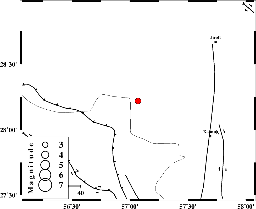
| Location | Lat:28.22 Lon: 57.07 |
| Region | Kerman Province, 68 km North-West of Kahnuj |
Nearest Cities |
|
| 23 km South East of Sarkhan, Kerman Province | |
| 24 km North West of Hurpasefid, Kerman Province | |
| 26 km North West of Faryab, Kerman Province | |
| 36 km North West of Mehrueye-e paeen, Kerman Province | |
| 47 km North West of Bolock, Kerman Province | |
| Depth | 14 km |
| Agency | |
Faults within 150 km: |
|
| MAIN_ZAGROS_R_F (Length: 1106 km) , Distance to epicenter: 32 km | |
| ZENDAN_MINAB_F_Z1 (Length: 183 km) , Distance to epicenter: 64 km | |
| SABZEVARAN_F (Length: 190 km) , Distance to epicenter: 65 km | |
| Number of Phases | 5 |
| RMS | 0.1 |
| Number of Stations | 5 |
| Error in Latitude | >2.2 km |
| Error in Longitude | 3.1 km |
| Error in Depth | 4.1 km |
Download waveform in seisan format
to download seisan software Click here
to access information about IIEES stations Click here
Amplitude | ||||||||
| UID | Agency | Station | Component | Amplitude | Period | Arrival Time | Proccessing Time | Signal Clip |
| 80651 | IIEES | BNDS | N | 888.1 | 0.57 | 2011-11-12 13:07:44 | 2011-11-12 12:27:00 | n |
| 80652 | IIEES | BNDS | E | 761.2 | 0.49 | 2011-11-12 13:07:47 | 2011-11-12 12:27:00 | n |
| 80653 | IIEES | KRBR | E | 196 | 0.38 | 2011-11-12 13:08:09 | 2011-11-12 12:27:00 | n |
| 80654 | IIEES | GHIR | N | 31.7 | 0.18 | 2011-11-12 13:08:48 | 2011-11-12 12:27:00 | n |
Phase | ||||||||||||
| Agency | Station | Component | Phase Type | Phase Quality | First Motion | Observed Arrival Time | Time Residual | Loc. Flag | Input Weight | Distance | Azimuth | |
| IIEES | BNDS | Z | Pg | E | 2011-11-12 13:07:26 | -0.07 | y | 127 | 224 | |||
| IIEES | KRBR | Z | Pg | E | 2011-11-12 13:07:37 | 0.01 | y | 197 | 351 | |||
| IIEES | ZHSF | Z | Pn | E | 2011-11-12 13:08:01 | 0.07 | y | 393 | 66 | |||
| IIEES | GHIR | Z | Pn | E | 2011-11-12 13:08:02 | 0.14 | y | 401 | 272 | |||
| IIEES | TABS | Z | Pn | E | 2011-11-12 13:08:27 | -0.19 | y | 602 | 0 | |||