
Magnitude |
:3 |
| Date & Time (UTC) | 2011-11-09 06:48:05.5 |
| Date & Time (Local) | 1390/8/18 10:18:05.5 |
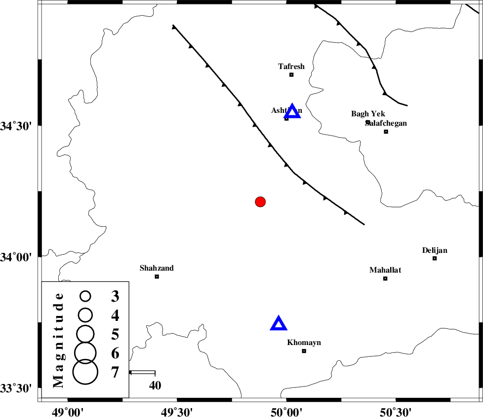
| Location | Lat:34.21 Lon: 49.88 |
| Region | Markazi Province, 22 km North-East of Arak |
Nearest Cities |
|
| 9 km of Davoodabad, Markazi Province | |
| 15 km North West of Ebrahimabad, Markazi Province | |
| 17 km East of Ebakabad, Markazi Province | |
| 23 km North East of Arak, Markazi Province | |
| 23 km North East of Marzijaran, Markazi Province | |
| Depth | 7 km |
| Agency | |
Faults within 150 km: |
|
| TAFRESH_F (Length: 117 km) , Distance to epicenter: 19 km | |
| INDES_F (Length: 98 km) , Distance to epicenter: 70 km | |
| MAIN_ZAGROS_R_F (Length: 1106 km) , Distance to epicenter: 101 km | |
| Number of Phases | 5 |
| RMS | 0.1 |
| Number of Stations | 5 |
| Error in Latitude | >2 km |
| Error in Longitude | 3.7 km |
| Error in Depth | 4.9 km |
Download waveform in seisan format
to download seisan software Click here
to access information about IIEES stations Click here
Amplitude | ||||||||
| UID | Agency | Station | Component | Amplitude | Period | Arrival Time | Proccessing Time | Signal Clip |
| 80634 | IIEES | KHMZ | E | 947.7 | 0.11 | 2011-11-09 06:48:22 | 2011-11-09 06:05:00 | n |
| 80635 | IIEES | GHVR | E | 561.1 | 0.4 | 2011-11-09 06:48:46 | 2011-11-09 06:05:00 | n |
| 80636 | IIEES | SNGE | N | 71.5 | 0.46 | 2011-11-09 06:49:18 | 2011-11-09 06:05:00 | n |
| 80637 | IIEES | SNGE | E | 65.2 | 0.29 | 2011-11-09 06:49:18 | 2011-11-09 06:05:00 | n |
Phase | ||||||||||||
| Agency | Station | Component | Phase Type | Phase Quality | First Motion | Observed Arrival Time | Time Residual | Loc. Flag | Input Weight | Distance | Azimuth | |
| IIEES | ASAO | Z | Pg | E | 2011-11-09 06:48:12 | -0.09 | y | 39.9 | 20 | |||
| IIEES | KHMZ | Z | Pg | E | 2011-11-09 06:48:14 | -0.09 | y | 52.8 | 171 | |||
| IIEES | GHVR | Z | Pg | E | 2011-11-09 06:48:28 | 0.19 | y | 129 | 76 | |||
| IIEES | THKV | Z | Pn | E | 2011-11-09 06:48:40 | -0.14 | y | 210 | 26 | |||
| IIEES | SNGE | Z | Pn | E | 2011-11-09 06:48:45 | 0.14 | y | 252 | 294 | |||