
Magnitude |
:3.6 |
| Date & Time (UTC) | 2011-11-08 20:11:13.3 |
| Date & Time (Local) | 1390/8/17 23:41:13.3 |
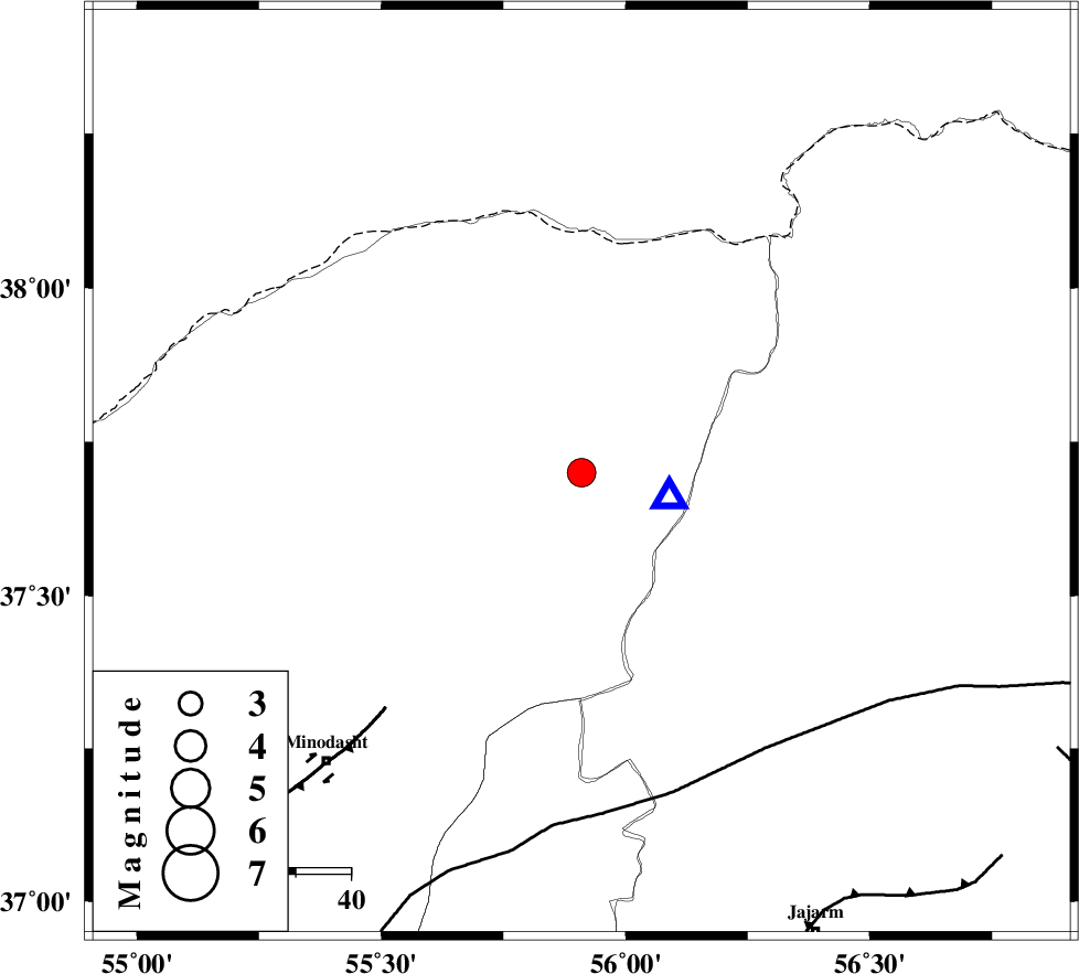
| Location | Lat:37.7 Lon: 55.91 |
| Region | Golestan Province, 51 km North-East of Kalaleh |
Nearest Cities |
|
| 7 km North of Golidagh, Golestan Province | |
| 23 km South of Moravehtappeh, Golestan Province | |
| 32 km North East of Pashikmar, Golestan Province | |
| 37 km West of Garmab, Khorasan(north) Province | |
| 38 km East of Qareh aghaj, Golestan Province | |
| Depth | 14 km |
| Agency | |
Faults within 150 km: |
|
| ROBATE_QARABIL_F (Length: 168 km) , Distance to epicenter: 60 km | |
| JAJARAM_F (Length: 77 km) , Distance to epicenter: 91 km | |
| ESFARAYEN_F (Length: 111 km) , Distance to epicenter: 99 km | |
| Number of Phases | 4 |
| RMS | 0.1 |
| Number of Stations | 3 |
| Error in Latitude | >5.5 km |
| Error in Longitude | 11.2 km |
| Error in Depth | 6.7 km |
Download waveform in seisan format
to download seisan software Click here
to access information about IIEES stations Click here
Amplitude | ||||||||
| UID | Agency | Station | Component | Amplitude | Period | Arrival Time | Proccessing Time | Signal Clip |
| 80623 | IIEES | MRVT | E | 9472.1 | 0.18 | 2011-11-08 20:11:21 | 2011-11-08 07:32:00 | n |
| 80624 | IIEES | SHRO | N | 946.5 | 0.94 | 2011-11-08 20:12:12 | 2011-11-08 07:32:00 | n |
Phase | ||||||||||||
| Agency | Station | Component | Phase Type | Phase Quality | First Motion | Observed Arrival Time | Time Residual | Loc. Flag | Input Weight | Distance | Azimuth | |
| IIEES | MRVT | Z | Pg | E | 2011-11-08 20:11:16 | -0.23 | y | 16.2 | 106 | |||
| IIEES | BJRD | Z | Pg | E | 2011-11-08 20:11:35 | 0.17 | y | 132 | 90 | |||
| IIEES | SHRO | Z | Pg | E | 2011-11-08 20:11:44 | 0.05 | y | 188 | 177 | |||
| IIEES | SHRO | E | Sg | E | 2011-11-08 20:12:06 | 0 | y | 188 | 177 | |||