
Magnitude |
:3.1 |
| Date & Time (UTC) | 2011-11-02 10:36:10.3 |
| Date & Time (Local) | 1390/8/11 14:06:10.3 |
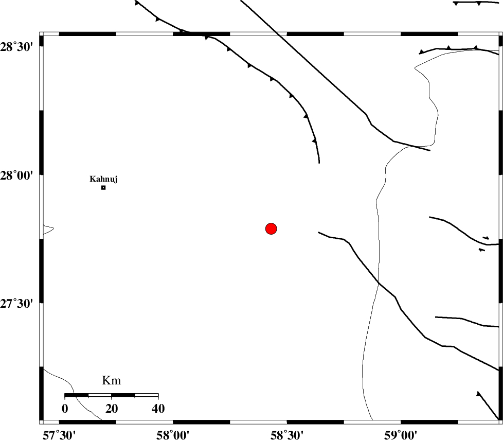
| Location | Lat:27.79 Lon: 58.43 |
| Region | Kerman Province, 74 km South-East of Kahnuj |
Nearest Cities |
|
| 28 km South of Borj-e abbasabad, Kerman Province | |
| 61 km North East of Qalehy-eganj, Kerman Province | |
| 67 km South East of Mardehak, Kerman Province | |
| 75 km South East of Kahnuj, Kerman Province | |
| 78 km North East of Bargah, Kerman Province | |
| Depth | 45 km |
| Agency | |
Faults within 150 km: |
|
| JIROFT_F (Length: 144 km) , Distance to epicenter: 61 km | |
| BAM_F (Length: 118 km) , Distance to epicenter: 65 km | |
| SABZEVARAN_F (Length: 190 km) , Distance to epicenter: 75 km | |
| Number of Phases | 5 |
| RMS | 0.2 |
| Number of Stations | 4 |
| Error in Latitude | >5 km |
| Error in Longitude | 5.2 km |
| Error in Depth | 9.2 km |
Download waveform in seisan format
to download seisan software Click here
to access information about IIEES stations Click here
Amplitude | ||||||||
| UID | Agency | Station | Component | Amplitude | Period | Arrival Time | Proccessing Time | Signal Clip |
| 80594 | IIEES | BNDS | N | 170.5 | 0.19 | 2011-11-02 10:37:17 | 2011-11-02 10:00:00 | n |
| 80595 | IIEES | CHBR | E | 59 | 0.23 | 2011-11-02 10:37:29 | 2011-11-02 10:00:00 | n |
| 80596 | IIEES | CHBR | N | 53.5 | 0.3 | 2011-11-02 10:37:31 | 2011-11-02 10:00:00 | n |
Phase | ||||||||||||
| Agency | Station | Component | Phase Type | Phase Quality | First Motion | Observed Arrival Time | Time Residual | Loc. Flag | Input Weight | Distance | Azimuth | |
| IIEES | BNDS | Z | Pg | E | 2011-11-02 10:36:47 | 0.2 | y | 227 | 259 | |||
| IIEES | BNDS | N | Sg | E | 2011-11-02 10:37:13 | -0.18 | y | 227 | 259 | |||
| IIEES | KRBR | Z | Pn | E | 2011-11-02 10:36:51 | -0.11 | y | 292 | 327 | |||
| IIEES | CHBR | Z | Pn | E | 2011-11-02 10:36:54 | -0.07 | y | 318 | 140 | |||
| IIEES | GHIR | Z | Pn | E | 2011-11-02 10:37:22 | 0.23 | y | 538 | 277 | |||