
Magnitude |
:3.3 |
| Date & Time (UTC) | 2011-09-29 03:51:02.3 |
| Date & Time (Local) | 1390/7/7 07:21:02.3 |
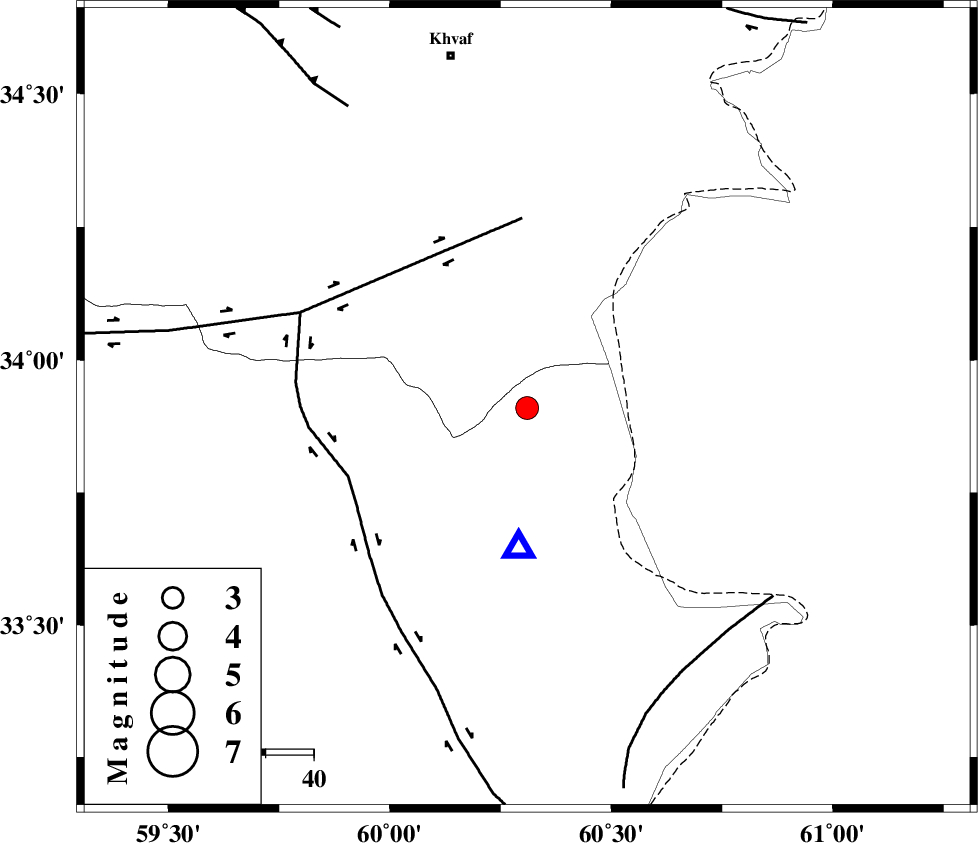
| Location | Lat:33.91 Lon: 60.31 |
| Region | 75 km South-East of Khaf |
Nearest Cities |
|
| 16 km South of Sirkhun, Khorasan(center) Province | |
| 27 km South West of Chahkand, Khorasan(center) Province | |
| 32 km North East of Shahdokht, Khorasan(south) Province | |
| 34 km South East of Pasgah-e chazul, Khorasan(center) Province | |
| 36 km South of Niyazabad, Khorasan(center) Province | |
| Depth | 14 km |
| Agency | |
Faults within 150 km: |
|
| DASHT_E_BAYAZ_F (Length: 177 km) , Distance to epicenter: 40 km | |
| ABRIZ_F (Length: 114 km) , Distance to epicenter: 40 km | |
| PATARGAN_F (Length: 52 km) , Distance to epicenter: 63 km | |
| Number of Phases | 5 |
| RMS | 0.1 |
| Number of Stations | 3 |
| Error in Latitude | >3.9 km |
| Error in Longitude | 7.3 km |
| Error in Depth | 4.1 km |
Download waveform in seisan format
to download seisan software Click here
to access information about IIEES stations Click here
Amplitude | ||||||||
| UID | Agency | Station | Component | Amplitude | Period | Arrival Time | Proccessing Time | Signal Clip |
| 80327 | IIEES | SHRT | E | 8286.4 | 0.29 | 2011-09-29 03:51:12 | 2011-09-29 04:09:00 | n |
| 80328 | IIEES | SHRT | N | 4278.7 | 0.59 | 2011-09-29 03:51:14 | 2011-09-29 04:09:00 | n |
| 80329 | IIEES | TABS | N | 99 | 0.82 | 2011-09-29 03:52:34 | 2011-09-29 04:09:00 | n |
| 80330 | IIEES | SHRO | E | 33 | 0.43 | 2011-09-29 03:53:18 | 2011-09-29 04:09:00 | n |
Phase | ||||||||||||
| Agency | Station | Component | Phase Type | Phase Quality | First Motion | Observed Arrival Time | Time Residual | Loc. Flag | Input Weight | Distance | Azimuth | |
| IIEES | SHRT | Z | Pg | E | 2011-09-29 03:51:08 | -0.02 | y | 29.7 | 183 | |||
| IIEES | SHRT | N | Sg | E | 2011-09-29 03:51:12 | -0.04 | y | 29.7 | 183 | |||
| IIEES | TABS | Z | Pn | E | 2011-09-29 03:51:47 | 0.19 | y | 297 | 265 | |||
| IIEES | SHRO | Z | Pn | E | 2011-09-29 03:52:06 | -0.05 | y | 456 | 302 | |||
| IIEES | SHRO | E | Sg | E | 2011-09-29 03:53:09 | -0.1 | y | 456 | 302 | |||