
Magnitude |
:2.5 |
| Date & Time (UTC) | 2011-09-22 21:40:48.1 |
| Date & Time (Local) | 1390/7/1 01:10:48.1 |
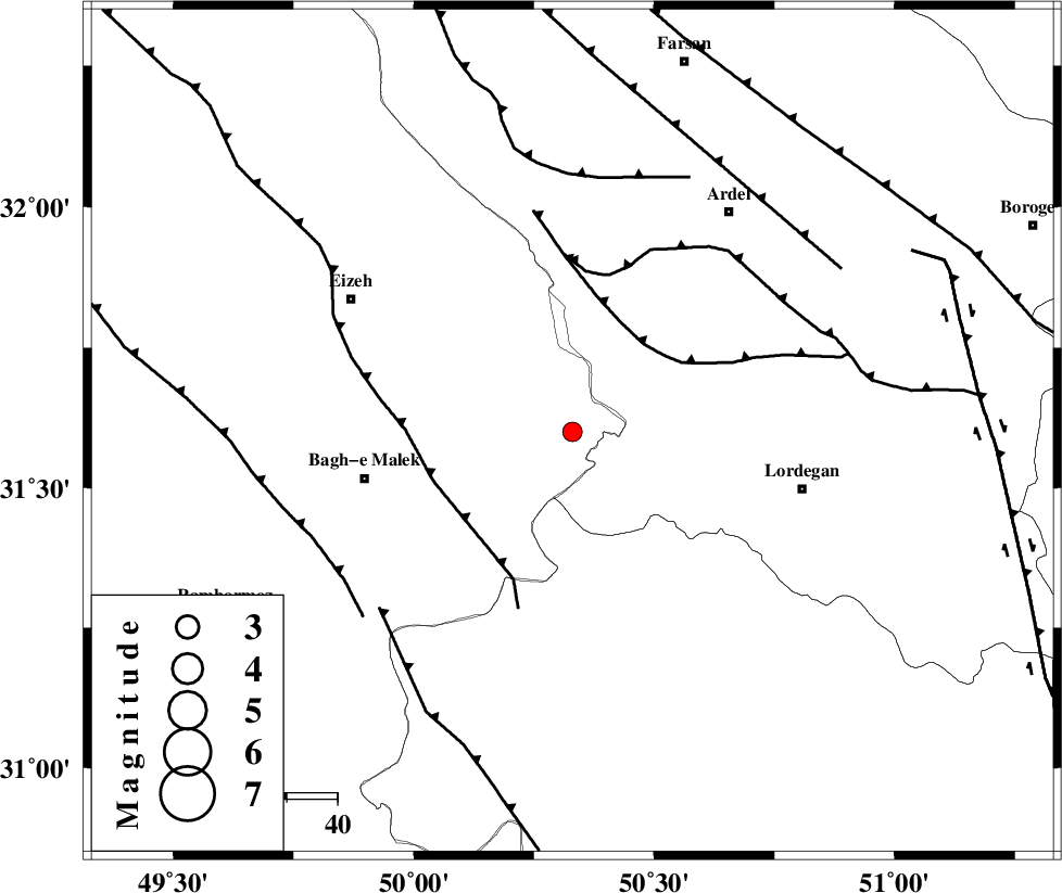
| Location | Lat:31.6 Lon: 50.33 |
| Region | Khoozestan Province, 42 km East of Bagh Malek |
Nearest Cities |
|
| 17 km South of Dehdez, Khoozestan Province | |
| 26 km South West of Sarkhun, Chaharmahal Bakhtiari Province | |
| 33 km North East of Abolabbas, Khoozestan Province | |
| 35 km North of Dishmuk, Kohkiluieh va boyerahmad Province | |
| 35 km North of Esfandan, Kohkiluieh va boyerahmad Province | |
| Depth | 14 km |
| Agency | |
Faults within 150 km: |
|
| SABZKUH_F (Length: 67 km) , Distance to epicenter: 22 km | |
| MFF2 (Length: 205 km) , Distance to epicenter: 29 km | |
| DOPOLAN_F (Length: 107 km) , Distance to epicenter: 32 km | |
| Number of Phases | 5 |
| RMS | 0.1 |
| Number of Stations | 4 |
| Error in Latitude | >2.6 km |
| Error in Longitude | 3.8 km |
| Error in Depth | 5.9 km |
Download waveform in seisan format
to download seisan software Click here
to access information about IIEES stations Click here
Amplitude | ||||||||
| UID | Agency | Station | Component | Amplitude | Period | Arrival Time | Proccessing Time | Signal Clip |
| 80284 | IIEES | SHGR | E | 123.5 | 0.8 | 2011-09-22 21:41:43 | 2011-09-22 11:02:00 | n |
| 80285 | IIEES | SHGR | N | 93 | 0.56 | 2011-09-22 21:41:48 | 2011-09-22 11:02:00 | n |
| 80286 | IIEES | KHMZ | E | 29.6 | 0.6 | 2011-09-22 21:42:01 | 2011-09-22 11:02:00 | n |
| 80287 | IIEES | KHMZ | N | 24.2 | 0.48 | 2011-09-22 21:42:01 | 2011-09-22 11:02:00 | n |
| 80288 | IIEES | ASAO | N | 18.6 | 0.72 | 2011-09-22 21:42:25 | 2011-09-22 11:02:00 | n |
| 80289 | IIEES | ASAO | E | 10.2 | 0.6 | 2011-09-22 21:42:40 | 2011-09-22 11:02:00 | n |
Phase | ||||||||||||
| Agency | Station | Component | Phase Type | Phase Quality | First Motion | Observed Arrival Time | Time Residual | Loc. Flag | Input Weight | Distance | Azimuth | |
| IIEES | SHGR | N | Pg | E | 2011-09-22 21:41:13 | -0.03 | y | 155 | 292 | |||
| IIEES | KHMZ | Z | Pn | E | 2011-09-22 21:41:25 | -0.02 | y | 240 | 352 | |||
| IIEES | KHMZ | E | Sg | E | 2011-09-22 21:41:56 | -0.03 | y | 240 | 352 | |||
| IIEES | NASN | Z | Pn | E | 2011-09-22 21:41:29 | -0.09 | y | 269 | 60 | |||
| IIEES | ASAO | Z | Pn | E | 2011-09-22 21:41:36 | 0.18 | y | 328 | 355 | |||