
Magnitude |
:3.2 |
| Date & Time (UTC) | 2011-09-22 18:27:13.1 |
| Date & Time (Local) | 1390/6/31 21:57:13.1 |
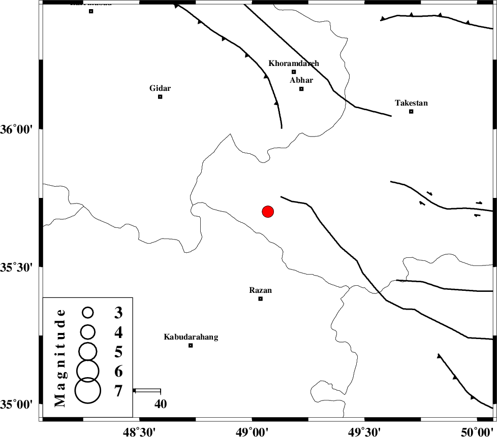
| Location | Lat:35.7 Lon: 49.07 |
| Region | Ghazvin Province, 36 km North of Razan |
Nearest Cities |
|
| 20 km North West of Avaj, Ghazvin Province | |
| 21 km West of Ab-e garm, Ghazvin Province | |
| 32 km North East of Khorandeh, Hamedan Province | |
| 34 km South West of Hoseynabad, Ghazvin Province | |
| 35 km North East of Kahla, Zanjan Province | |
| Depth | 15 km |
| Agency | |
Faults within 150 km: |
|
| KUSHK_E_NOSRAT_F (Length: 230 km) , Distance to epicenter: 8 km | |
| SOLTANIYEH_F (Length: 119 km) , Distance to epicenter: 34 km | |
| IPAK_F (Length: 80 km) , Distance to epicenter: 51 km | |
| Number of Phases | 7 |
| RMS | 0.4 |
| Number of Stations | 7 |
| Error in Latitude | >3.8 km |
| Error in Longitude | 4.4 km |
| Error in Depth | 6 km |
Download waveform in seisan format
to download seisan software Click here
to access information about IIEES stations Click here
Amplitude | ||||||||
| UID | Agency | Station | Component | Amplitude | Period | Arrival Time | Proccessing Time | Signal Clip |
| 80278 | IIEES | SNGE | E | 186.7 | 0.58 | 2011-09-22 18:28:03 | 2011-09-22 06:48:00 | n |
| 80279 | IIEES | SNGE | N | 488.7 | 0.48 | 2011-09-22 18:28:03 | 2011-09-22 06:48:00 | n |
| 80280 | IIEES | KHMZ | E | 204.2 | 0.36 | 2011-09-22 18:28:22 | 2011-09-22 06:48:00 | n |
| 80281 | IIEES | KHMZ | N | 125 | 0.36 | 2011-09-22 18:28:24 | 2011-09-22 06:48:00 | n |
| 80282 | IIEES | GHVR | E | 109 | 0.56 | 2011-09-22 18:28:29 | 2011-09-22 06:48:00 | n |
| 80283 | IIEES | GHVR | N | 127.3 | 0.44 | 2011-09-22 18:28:33 | 2011-09-22 06:48:00 | n |
Phase | ||||||||||||
| Agency | Station | Component | Phase Type | Phase Quality | First Motion | Observed Arrival Time | Time Residual | Loc. Flag | Input Weight | Distance | Azimuth | |
| IIEES | ZNJK | Z | Pg | E | 2011-09-22 18:27:32 | 0.02 | y | 113 | 342 | |||
| IIEES | ASAO | Z | Pg | E | 2011-09-22 18:27:38 | -0.48 | y | 155 | 146 | |||
| IIEES | THKV | Z | Pg | E | 2011-09-22 18:27:40 | 0.05 | y | 165 | 81 | |||
| IIEES | SNGE | Z | Pg | E | 2011-09-22 18:27:41 | -0.02 | y | 171 | 247 | |||
| IIEES | CHTH | Z | Pn | E | 2011-09-22 18:27:43 | -0.41 | y | 187 | 82 | |||
| IIEES | KHMZ | Z | Pn | E | 2011-09-22 18:27:49 | 0.07 | y | 232 | 159 | |||
| IIEES | GHVR | Z | Pn | E | 2011-09-22 18:27:51 | 0.78 | y | 240 | 124 | |||