
Magnitude |
:2.7 |
| Date & Time (UTC) | 2011-08-30 11:47:55.0 |
| Date & Time (Local) | 1390/6/8 16:17:55.0 |
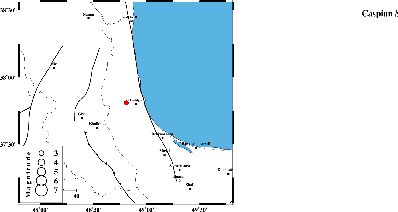
| Location | Lat:37.81 Lon: 48.81 |
| Region | Gilan Province, 8 km Hashtpar |
Nearest Cities |
|
| 2 km of Kish dini, Gilan Province | |
| 8 km North of Hashtpar, Gilan Province | |
| 9 km North West of Hashtpar, Gilan Province | |
| 10 km West of Chelonasr, Gilan Province | |
| 13 km North West of Tularud, Gilan Province | |
| Depth | 15 km |
| Agency | |
Faults within 150 km: |
|
| TALESH_F (Length: 258 km) , Distance to epicenter: 17 km | |
| SANGAVAR_F (Length: 61 km) , Distance to epicenter: 34 km | |
| MASULEL_F (Length: 90 km) , Distance to epicenter: 42 km | |
| Number of Phases | 4 |
| RMS | 0 |
| Number of Stations | 4 |
| Error in Latitude | >5 km |
| Error in Longitude | 17.1 km |
| Error in Depth | 5.7 km |
Download waveform in seisan format
to download seisan software Click here
to access information about IIEES stations Click here
Amplitude | ||||||||
| UID | Agency | Station | Component | Amplitude | Period | Arrival Time | Proccessing Time | Signal Clip |
| 80117 | IIEES | GRMI | E | 211.5 | 0.59 | 2011-08-30 11:48:37 | 2011-08-30 12:31:00 | n |
| 80118 | IIEES | GRMI | N | 194.2 | 0.08 | 2011-08-30 11:48:39 | 2011-08-30 12:31:00 | n |
| 80119 | IIEES | SNGE | E | 15 | 0.64 | 2011-08-30 11:49:25 | 2011-08-30 12:31:00 | n |
Phase | ||||||||||||
| Agency | Station | Component | Phase Type | Phase Quality | First Motion | Observed Arrival Time | Time Residual | Loc. Flag | Input Weight | Distance | Azimuth | |
| IIEES | ZNJK | Z | Pg | E | 2011-08-30 11:48:16 | 0 | y | 127 | 185 | |||
| IIEES | GRMI | Z | Pg | E | 2011-08-30 11:48:17 | 0 | y | 137 | 324 | |||
| IIEES | GRMI | E | Sg | E | 2011-08-30 11:48:34 | 0 | y | 137 | 324 | |||
| IIEES | SNGE | Z | Pn | E | 2011-08-30 11:48:43 | 0 | y | 329 | 204 | |||