
Magnitude |
:3.2 |
| Date & Time (UTC) | 2011-08-28 19:27:23.7 |
| Date & Time (Local) | 1390/6/6 23:57:23.7 |
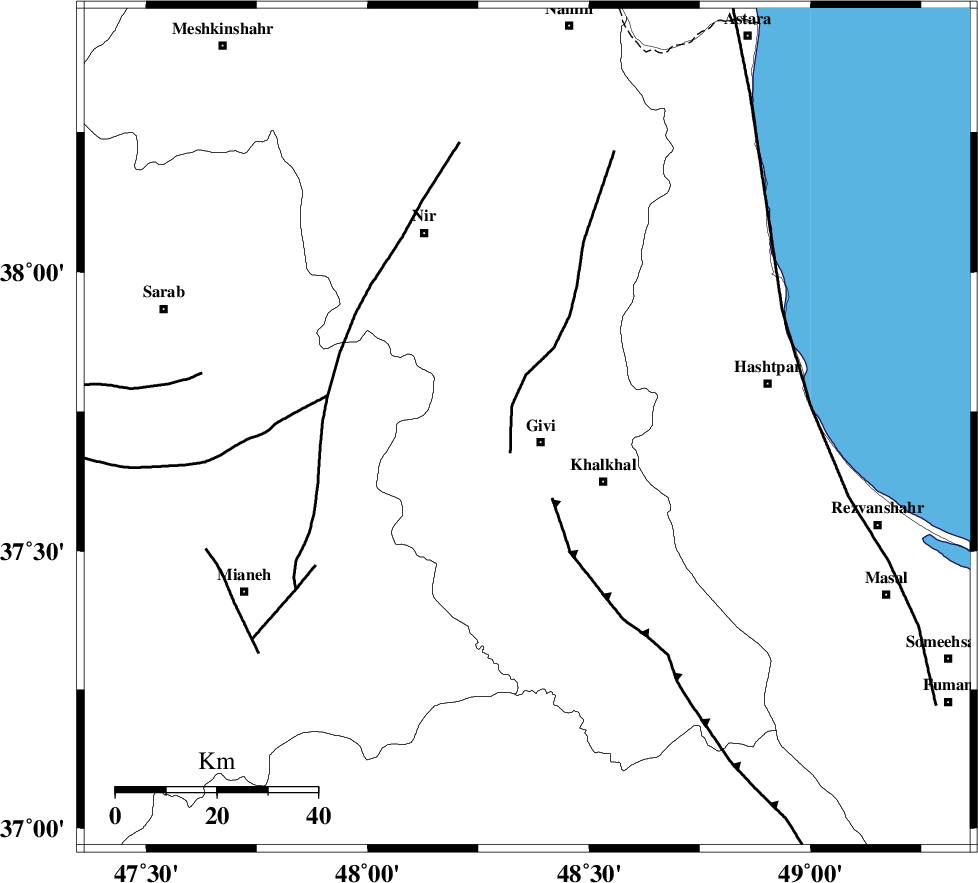
| Location | Lat:37.72 Lon: 48.36 |
| Region | Ardebil Province, 4 km Givi |
Nearest Cities |
|
| 4 km North of Givi, Ardebil Province | |
| 8 km North of Ganjgah, Ardebil Province | |
| 16 km North East of Firuz Abad, Ardebil Province | |
| 17 km North of Gazaz, Ardebil Province | |
| 18 km North West of Khalkhal, Ardebil Province | |
| Depth | 14 km |
| Agency | |
Faults within 150 km: |
|
| SANGAVAR_F (Length: 61 km) , Distance to epicenter: 3 km | |
| MASULEL_F (Length: 90 km) , Distance to epicenter: 15 km | |
| BOZQUSH (Length: 70 km) , Distance to epicenter: 40 km | |
| Number of Phases | 6 |
| RMS | 0.1 |
| Number of Stations | 4 |
| Error in Latitude | >0.9 km |
| Error in Longitude | 3.8 km |
| Error in Depth | 5 km |
Download waveform in seisan format
to download seisan software Click here
to access information about IIEES stations Click here
Amplitude | ||||||||
| UID | Agency | Station | Component | Amplitude | Period | Arrival Time | Proccessing Time | Signal Clip |
| 80112 | IIEES | GRMI | N | 474 | 0.2 | 2011-08-28 19:28:04 | 2011-08-28 07:42:00 | n |
| 80113 | IIEES | GRMI | E | 484.6 | 0.32 | 2011-08-28 19:28:04 | 2011-08-28 07:42:00 | n |
| 80114 | IIEES | THKV | N | 95.5 | 0.48 | 2011-08-28 19:28:49 | 2011-08-28 07:42:00 | n |
Phase | ||||||||||||
| Agency | Station | Component | Phase Type | Phase Quality | First Motion | Observed Arrival Time | Time Residual | Loc. Flag | Input Weight | Distance | Azimuth | |
| IIEES | GRMI | Z | Pg | E | 2011-08-28 19:27:44 | -0.08 | y | 127 | 341 | |||
| IIEES | GRMI | E | Sg | E | 2011-08-28 19:28:00 | 0.06 | y | 127 | 341 | |||
| IIEES | THKV | Z | P | E | 2011-08-28 19:28:08 | -0.06 | y | 301 | 131 | |||
| IIEES | SNGE | Z | Pn | E | 2011-08-28 19:28:09 | -0.01 | y | 306 | 198 | |||
| IIEES | SNGE | E | Sg | E | 2011-08-28 19:28:49 | 0.02 | y | 306 | 198 | |||
| IIEES | CHTH | Z | Pn | E | 2011-08-28 19:28:11 | 0.08 | y | 318 | 128 | |||