
Magnitude |
:3.9 |
| Date & Time (UTC) | 2011-05-30 07:43:26.5 |
| Date & Time (Local) | 1390/3/9 12:13:26.5 |
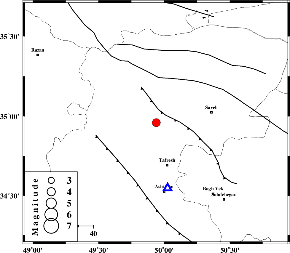
| Location | Lat:34.96 Lon: 49.94 |
| Region | Markazi Province, 31 km North of Tafresh |
Nearest Cities |
|
| 14 km of Qeytaniyeh, Markazi Province | |
| 16 km North West of Khanak, Markazi Province | |
| 19 km North of Bazarjan, Markazi Province | |
| 20 km South East of Gharqabad, Markazi Province | |
| 22 km North East of Jaghtan, Markazi Province | |
| Depth | 15 km |
| Agency | |
Faults within 150 km: |
|
| INDES_F (Length: 98 km) , Distance to epicenter: 8 km | |
| KUSHK_E_NOSRAT_F (Length: 230 km) , Distance to epicenter: 31 km | |
| TAFRESH_F (Length: 117 km) , Distance to epicenter: 37 km | |
| Number of Phases | 7 |
| RMS | 0.3 |
| Number of Stations | 7 |
| Error in Latitude | >4.9 km |
| Error in Longitude | 5.1 km |
| Error in Depth | 8.7 km |
Download waveform in seisan format
to download seisan software Click here
to access information about IIEES stations Click here
Amplitude | ||||||||
| UID | Agency | Station | Component | Amplitude | Period | Arrival Time | Proccessing Time | Signal Clip |
| 79166 | IIEES | GHVR | N | 1921.9 | 0.43 | 2011-05-30 07:44:14 | 2011-05-30 08:16:00 | n |
| 79167 | IIEES | SNGE | N | 816.1 | 0.56 | 2011-05-30 07:44:44 | 2011-05-30 08:16:00 | n |
| 79168 | IIEES | NASN | E | 292.6 | 0.55 | 2011-05-30 07:45:06 | 2011-05-30 08:16:00 | n |
Phase | ||||||||||||
| Agency | Station | Component | Phase Type | Phase Quality | First Motion | Observed Arrival Time | Time Residual | Loc. Flag | Input Weight | Distance | Azimuth | |
| IIEES | GHVR | Z | Pg | E | 2011-05-30 07:43:48 | -0.1 | y | 131 | 114 | |||
| IIEES | THKV | N | Pg | E | 2011-05-30 07:43:49 | 0.4 | y | 136 | 39 | |||
| IIEES | CHTH | Z | Pg | E | 2011-05-30 07:43:51 | -0.3 | y | 150 | 45 | |||
| IIEES | SNGE | Z | Pn | E | 2011-05-30 07:44:03 | -0.1 | y | 237 | 274 | |||
| IIEES | NASN | Z | Pn | E | 2011-05-30 07:44:19 | 0.3 | y | 357 | 131 | |||
| IIEES | SHRO | N | Pn | E | 2011-05-30 07:44:43 | -0.3 | y | 563 | 76 | |||
| IIEES | TABS | Z | Pn | E | 2011-05-30 07:44:58 | 0 | y | 676 | 100 | |||