
Magnitude |
:3.8 |
| Date & Time (UTC) | 2011-05-15 13:41:00.2 |
| Date & Time (Local) | 1390/2/25 18:11:00.2 |
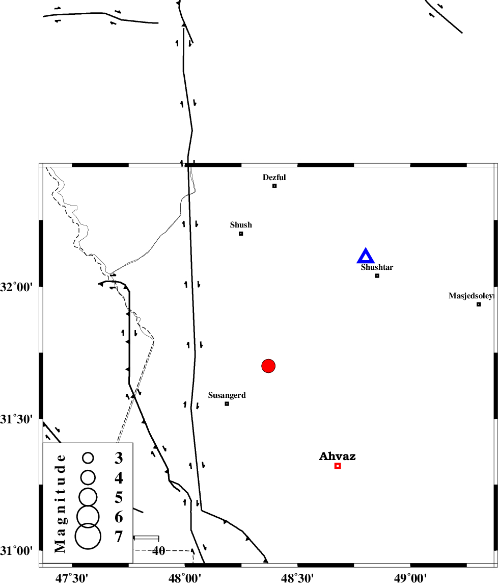
| Location | Lat:31.7 Lon: 48.37 |
| Region | Khoozestan Province, 24 km North-East of Susangerd |
Nearest Cities |
|
| 14 km South of Abdolkhan-eali, Khoozestan Province | |
| 21 km North East of Jalaliyeh, Khoozestan Province | |
| 24 km North East of Susangerd, Khoozestan Province | |
| 25 km North of Hamidiyeh, Khoozestan Province | |
| 28 km North of Dehkade, Khoozestan Province | |
| Depth | 14 km |
| Agency | |
Faults within 150 km: |
|
| AHVAZ_F (Length: 99 km) , Distance to epicenter: 14 km | |
| DEZFUL_EMBAYMENT (Length: 228 km) , Distance to epicenter: 77 km | |
| AGHAJARI_F (Length: 88 km) , Distance to epicenter: 99 km | |
| Number of Phases | 6 |
| RMS | 0.1 |
| Number of Stations | 5 |
| Error in Latitude | >3.5 km |
| Error in Longitude | 4.1 km |
| Error in Depth | 5.2 km |
Download waveform in seisan format
to download seisan software Click here
to access information about IIEES stations Click here
Amplitude | ||||||||
| UID | Agency | Station | Component | Amplitude | Period | Arrival Time | Proccessing Time | Signal Clip |
| 78986 | IIEES | SHGR | N | 5027.5 | 0.64 | 2011-05-15 13:41:25 | 2011-05-15 01:50:00 | n |
| 78987 | IIEES | SHGR | E | 6048.2 | 0.56 | 2011-05-15 13:41:26 | 2011-05-15 01:50:00 | n |
| 78988 | IIEES | ASAO | E | 184 | 0.68 | 2011-05-15 13:42:49 | 2011-05-15 01:50:00 | n |
| 78989 | IIEES | ASAO | N | 253.3 | 0.68 | 2011-05-15 13:42:55 | 2011-05-15 01:50:00 | n |
| 78990 | IIEES | SNGE | N | 224.2 | 0.76 | 2011-05-15 13:43:02 | 2011-05-15 01:50:00 | n |
| 78991 | IIEES | SNGE | E | 196.5 | 0.68 | 2011-05-15 13:43:04 | 2011-05-15 01:50:00 | n |
Phase | ||||||||||||
| Agency | Station | Component | Phase Type | Phase Quality | First Motion | Observed Arrival Time | Time Residual | Loc. Flag | Input Weight | Distance | Azimuth | |
| IIEES | SHGR | Z | Pg | E | 2011-05-15 13:41:10 | -0.1 | y | 60.6 | 42 | |||
| IIEES | KHMZ | Z | P | E | 2011-05-15 13:41:41 | 0 | y | 271 | 33 | |||
| IIEES | KHMZ | E | Sg | E | 2011-05-15 13:42:16 | 0 | y | 271 | 33 | |||
| IIEES | ASAO | Z | P | E | 2011-05-15 13:41:51 | 0 | y | 351 | 26 | |||
| IIEES | SNGE | Z | P | E | 2011-05-15 13:41:56 | 0 | y | 388 | 346 | |||
| IIEES | NASN | Z | P | E | 2011-05-15 13:42:02 | 0.1 | y | 435 | 73 | |||