
Magnitude |
:3.5 |
| Date & Time (UTC) | 2011-05-12 18:45:56.8 |
| Date & Time (Local) | 1390/2/22 23:15:56.8 |
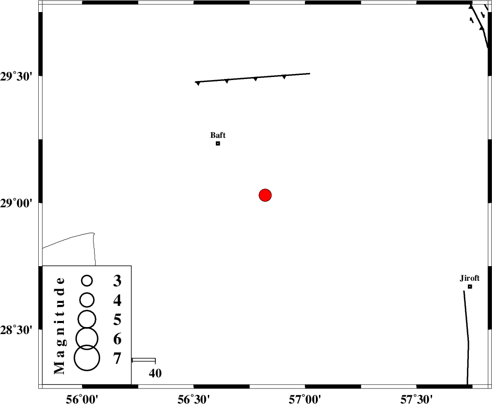
| Location | Lat:29.03 Lon: 56.82 |
| Region | Kerman Province, 31 km South-East of Baft |
Nearest Cities |
|
| 21 km North East of Kashkueyeh, Kerman Province | |
| 28 km South East of Bezanjan, Kerman Province | |
| 30 km South of Rabar, Kerman Province | |
| 31 km South East of Baft, Kerman Province | |
| 31 km South of Askar, Kerman Province | |
| Depth | 30 km |
| Agency | |
Faults within 150 km: |
|
| LALEHZAR_F (Length: 52 km) , Distance to epicenter: 57 km | |
| SABZEVARAN_F (Length: 190 km) , Distance to epicenter: 96 km | |
| MAIN_ZAGROS_R_F (Length: 1106 km) , Distance to epicenter: 101 km | |
| Number of Phases | 6 |
| RMS | 0.2 |
| Number of Stations | 4 |
| Error in Latitude | >1.9 km |
| Error in Longitude | 5.6 km |
| Error in Depth | 5.1 km |
Download waveform in seisan format
to download seisan software Click here
to access information about IIEES stations Click here
Amplitude | ||||||||
| UID | Agency | Station | Component | Amplitude | Period | Arrival Time | Proccessing Time | Signal Clip |
| 78933 | IIEES | KRBR | N | 1576.8 | 0.4 | 2011-05-12 18:46:30 | 2011-05-12 07:02:00 | n |
| 78934 | IIEES | KRBR | E | 1273.6 | 0.28 | 2011-05-12 18:46:34 | 2011-05-12 07:02:00 | n |
| 78935 | IIEES | BNDS | E | 401.2 | 0.6 | 2011-05-12 18:46:54 | 2011-05-12 07:02:00 | n |
| 78936 | IIEES | BNDS | N | 444.2 | 0.52 | 2011-05-12 18:46:56 | 2011-05-12 07:02:00 | n |
Phase | ||||||||||||
| Agency | Station | Component | Phase Type | Phase Quality | First Motion | Observed Arrival Time | Time Residual | Loc. Flag | Input Weight | Distance | Azimuth | |
| IIEES | KRBR | Z | Pg | E | 2011-05-12 18:46:14 | -0.1 | y | 106 | 357 | |||
| IIEES | KRBR | E | Sg | E | 2011-05-12 18:46:28 | 0.1 | y | 106 | 357 | |||
| IIEES | BNDS | Z | Pn | E | 2011-05-12 18:46:27 | 0.3 | y | 191 | 200 | |||
| IIEES | BNDS | E | Sg | E | 2011-05-12 18:46:50 | 0 | y | 191 | 200 | |||
| IIEES | GHIR | Z | Pn | E | 2011-05-12 18:46:50 | -0.2 | y | 383 | 259 | |||
| IIEES | CHBR | Z | Pn | E | 2011-05-12 18:47:07 | -0.2 | y | 525 | 135 | |||