
Magnitude |
:3.3 |
| Date & Time (UTC) | 2011-04-11 16:47:57.6 |
| Date & Time (Local) | 1390/1/22 21:17:57.6 |
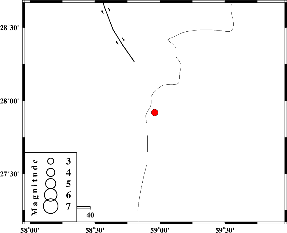
| Location | Lat:27.92 Lon: 58.96 |
| Region | Sistan va Baloochestan Province, 125 km East of Kahnuj |
Nearest Cities |
|
| 45 km South East of Borj-e abbasabad, Kerman Province | |
| 70 km North West of Kalemursi, Sistan va Baloochestan Province | |
| 88 km South West of Hoseynabad, Kerman Province | |
| 89 km South of Mohammadabad-e gonbaki, Kerman Province | |
| 91 km South East of Mardehak, Kerman Province | |
| Depth | 15 km |
| Agency | |
Faults within 150 km: |
|
| BAM_F (Length: 118 km) , Distance to epicenter: 42 km | |
| JIROFT_F (Length: 144 km) , Distance to epicenter: 113 km | |
| S_JAZMURIAN_F (Length: 91 km) , Distance to epicenter: 114 km | |
| Number of Phases | 4 |
| RMS | 0.3 |
| Number of Stations | 4 |
| Error in Latitude | >5.8 km |
| Error in Longitude | 4.1 km |
| Error in Depth | 0 km |
Download waveform in seisan format
to download seisan software Click here
to access information about IIEES stations Click here
Amplitude | ||||||||
| UID | Agency | Station | Component | Amplitude | Period | Arrival Time | Proccessing Time | Signal Clip |
| 78682 | IIEES | BNDS | E | 97.7 | 0.6 | 2011-04-11 16:49:22 | 2011-04-11 05:06:00 | n |
| 78683 | IIEES | BNDS | N | 155.7 | 0.48 | 2011-04-11 16:49:23 | 2011-04-11 05:06:00 | n |
| 78684 | IIEES | KRBR | E | 134.7 | 0.72 | 2011-04-11 16:49:25 | 2011-04-11 05:06:00 | n |
| 78685 | IIEES | KRBR | N | 113.4 | 0.56 | 2011-04-11 16:49:27 | 2011-04-11 05:06:00 | n |
Phase | ||||||||||||
| Agency | Station | Component | Phase Type | Phase Quality | First Motion | Observed Arrival Time | Time Residual | Loc. Flag | Input Weight | Distance | Azimuth | |
| IIEES | ZHSF | E | Pn | E | 2011-04-11 16:48:37 | 0.3 | y | 258 | 43 | |||
| IIEES | BNDS | Z | Pn | E | 2011-04-11 16:48:40 | 0.4 | y | 281 | 259 | |||
| IIEES | CHBR | Z | Pn | E | 2011-04-11 16:48:42 | -0.2 | y | 299 | 149 | |||
| IIEES | KRBR | Z | Pn | E | 2011-04-11 16:48:44 | -0.5 | y | 314 | 317 | |||