
Magnitude |
:3.4 |
| Date & Time (UTC) | 2011-03-23 03:00:21.5 |
| Date & Time (Local) | 1390/1/3 07:30:21.5 |
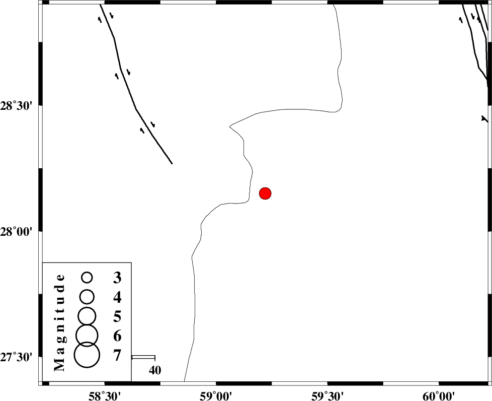
| Location | Lat:28.15 Lon: 59.22 |
| Region | Sistan va Baloochestan Province, 152 km North-East of Kahnuj |
Nearest Cities |
|
| 63 km South East of Hoseynabad, Kerman Province | |
| 71 km North East of Borj-e abbasabad, Kerman Province | |
| 72 km South East of Mohammadabad-e gonbaki, Kerman Province | |
| 80 km North West of Kalemursi, Sistan va Baloochestan Province | |
| 86 km South East of Void, Kerman Province | |
| Depth | 14 km |
| Agency | |
Faults within 150 km: |
|
| BAM_F (Length: 118 km) , Distance to epicenter: 43 km | |
| KANURAK_F (Length: 135 km) , Distance to epicenter: 97 km | |
| KASKIN_F (Length: 100 km) , Distance to epicenter: 101 km | |
| Number of Phases | 5 |
| RMS | 0.1 |
| Number of Stations | 4 |
| Error in Latitude | >6.8 km |
| Error in Longitude | 4.5 km |
| Error in Depth | 9.7 km |
Download waveform in seisan format
to download seisan software Click here
to access information about IIEES stations Click here
Amplitude | ||||||||
| UID | Agency | Station | Component | Amplitude | Period | Arrival Time | Proccessing Time | Signal Clip |
| 78427 | IIEES | BNDS | E | 139 | 0.56 | 2011-03-23 03:01:57 | 2011-03-23 03:40:00 | n |
| 78428 | IIEES | BNDS | N | 195 | 0.56 | 2011-03-23 03:01:57 | 2011-03-23 03:40:00 | n |
| 78429 | IIEES | KRBR | E | 86.2 | 0.76 | 2011-03-23 03:02:03 | 2011-03-23 03:40:00 | n |
Phase | ||||||||||||
| Agency | Station | Component | Phase Type | Phase Quality | First Motion | Observed Arrival Time | Time Residual | Loc. Flag | Input Weight | Distance | Azimuth | |
| IIEES | ZHSF | Z | P | E | 2011-03-23 03:00:57 | 0.1 | y | 222 | 43 | |||
| IIEES | ZHSF | E | Sg | E | 2011-03-23 03:01:24 | 0 | y | 222 | 43 | |||
| IIEES | BNDS | Z | P | E | 2011-03-23 03:01:07 | -0.2 | y | 312 | 255 | |||
| IIEES | KRBR | Z | P | E | 2011-03-23 03:01:08 | 0 | y | 314 | 311 | |||
| IIEES | GHIR | Z | P | E | 2011-03-23 03:01:45 | 0.2 | y | 612 | 273 | |||