
Magnitude |
:3.1 |
| Date & Time (UTC) | 2011-03-19 23:24:09.5 |
| Date & Time (Local) | 1389/12/29 02:54:09.5 |
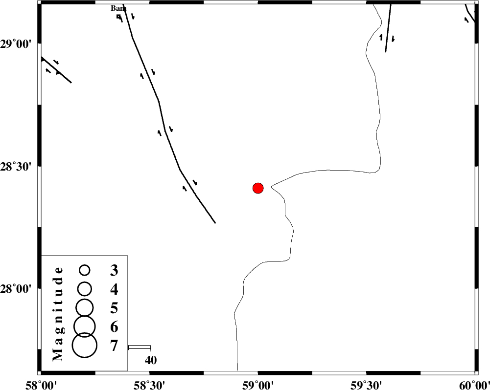
| Location | Lat:28.41 Lon: 59 |
| Region | Kerman Province, 100 km South-East of Bam |
Nearest Cities |
|
| 33 km South of Hoseynabad, Kerman Province | |
| 36 km South East of Mohammadabad-e gonbaki, Kerman Province | |
| 52 km South East of Void, Kerman Province | |
| 62 km South East of Fahroj, Kerman Province | |
| 64 km North East of Borj-e abbasabad, Kerman Province | |
| Depth | 15 km |
| Agency | |
Faults within 150 km: |
|
| BAM_F (Length: 118 km) , Distance to epicenter: 25 km | |
| KANURAK_F (Length: 135 km) , Distance to epicenter: 84 km | |
| GOWK_F (Length: 152 km) , Distance to epicenter: 97 km | |
| Number of Phases | 4 |
| RMS | 0 |
| Number of Stations | 3 |
| Error in Latitude | >4.6 km |
| Error in Longitude | 7.9 km |
| Error in Depth | 16.6 km |
Download waveform in seisan format
to download seisan software Click here
to access information about IIEES stations Click here
Amplitude | ||||||||
| UID | Agency | Station | Component | Amplitude | Period | Arrival Time | Proccessing Time | Signal Clip |
| 78367 | IIEES | KRBR | E | 109.2 | 0.11 | 2011-03-19 23:25:35 | 2011-03-19 11:39:00 | n |
| 78368 | IIEES | KRBR | N | 113.1 | 0.48 | 2011-03-19 23:25:36 | 2011-03-19 11:39:00 | n |
| 78369 | IIEES | BNDS | N | 59 | 0.47 | 2011-03-19 23:25:36 | 2011-03-19 11:39:00 | n |
| 78370 | IIEES | BNDS | E | 72.8 | 0.19 | 2011-03-19 23:25:43 | 2011-03-19 11:39:00 | n |
Phase | ||||||||||||
| Agency | Station | Component | Phase Type | Phase Quality | First Motion | Observed Arrival Time | Time Residual | Loc. Flag | Input Weight | Distance | Azimuth | |
| IIEES | ZHSF | Z | Pg | E | 2011-03-19 23:24:45 | 0 | y | 218 | 52 | |||
| IIEES | ZHSF | E | Sg | E | 2011-03-19 23:25:11 | 0 | y | 218 | 52 | |||
| IIEES | KRBR | Z | Pn | E | 2011-03-19 23:24:52 | 0 | y | 279 | 309 | |||
| IIEES | BNDS | Z | Pn | E | 2011-03-19 23:24:54 | 0 | y | 300 | 249 | |||