
Magnitude |
:3.1 |
| Date & Time (UTC) | 2011-03-11 16:38:28.6 |
| Date & Time (Local) | 1389/12/20 20:08:28.6 |
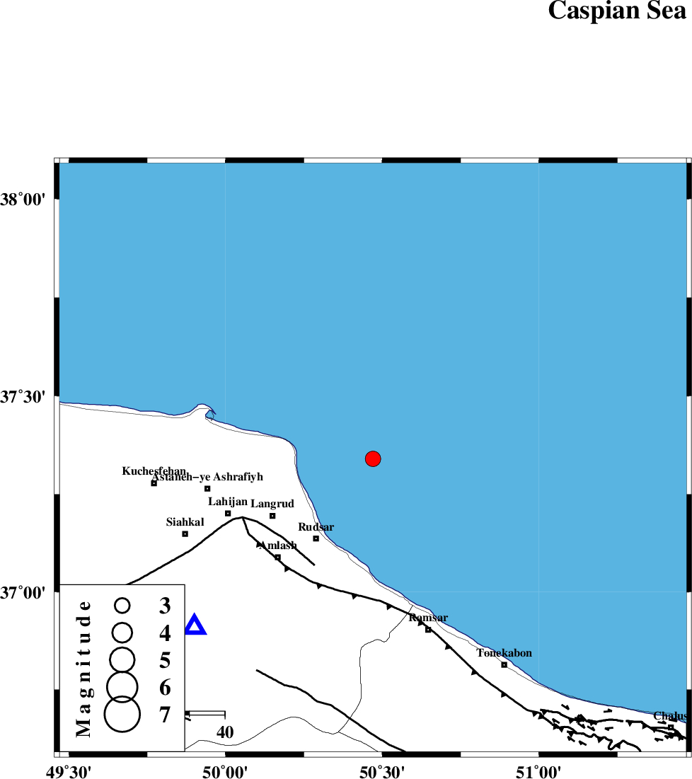
| Location | Lat:37.34 Lon: 50.47 |
| Region | Caspian Sea, 28 km North-East of Rudsar |
Nearest Cities |
|
| 24 km North East of Chali-ye paeen, Gilan Province | |
| 24 km North East of Latlil, Gilan Province | |
| 26 km North East of Kohnehgorab, Gilan Province | |
| 28 km North East of Rudsar, Gilan Province | |
| 28 km North East of Rezamahalleh, Gilan Province | |
| Depth | 38 km |
| Agency | |
Faults within 150 km: |
|
| LAHIJAN_F (Length: 92 km) , Distance to epicenter: 34 km | |
| KHAZAR_F (Length: 523 km) , Distance to epicenter: 39 km | |
| BONAN_F (Length: 74 km) , Distance to epicenter: 69 km | |
| Number of Phases | 4 |
| RMS | 0 |
| Number of Stations | 5 |
| Error in Latitude | >3.3 km |
| Error in Longitude | 3.2 km |
| Error in Depth | 3.5 km |
Download waveform in seisan format
to download seisan software Click here
to access information about IIEES stations Click here
Amplitude | ||||||||
| UID | Agency | Station | Component | Amplitude | Period | Arrival Time | Proccessing Time | Signal Clip |
| 78277 | IIEES | THKV | N | 494.3 | 1.21 | 2011-03-11 16:39:20 | 2011-03-11 05:20:00 | n |
| 78278 | IIEES | THKV | E | 423.7 | 0.7 | 2011-03-11 16:39:21 | 2011-03-11 05:20:00 | n |
| 78279 | IIEES | ASAO | E | 37.8 | 0.49 | 2011-03-11 16:40:00 | 2011-03-11 05:20:00 | n |
| 78280 | IIEES | GHVR | E | 36.1 | 0 | 2011-03-11 16:40:11 | 2011-03-11 05:20:00 | n |
Phase | ||||||||||||
| Agency | Station | Component | Phase Type | Phase Quality | First Motion | Observed Arrival Time | Time Residual | Loc. Flag | Input Weight | Distance | Azimuth | |
| IIEES | THKV | N | Sg | E | 2011-03-11 16:39:14 | 0 | y | 162 | 167 | |||
| IIEES | ZNJK | Z | Pg | E | 2011-03-11 16:38:57 | 0 | y | 175 | 245 | |||
| IIEES | DAMV | Z | Pg | E | 2011-03-11 16:39:06 | 0 | y | 233 | 144 | |||
| IIEES | ASAO | Z | Pn | E | 2011-03-11 16:39:13 | 0 | y | 312 | 187 | |||