
Magnitude |
:4.9 |
| Date & Time (UTC) | 2011-03-05 20:42:52.8 |
| Date & Time (Local) | 1389/12/15 00:12:52.8 |
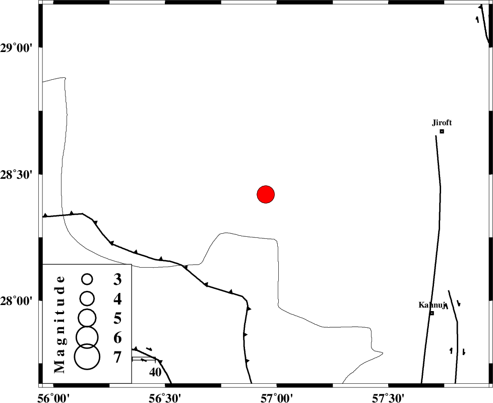
| Location | Lat:28.42 Lon: 56.95 |
| Region | Kerman Province, 83 km South-West of Jiroft |
Nearest Cities |
|
| 11 km North of Sarkhan, Kerman Province | |
| 35 km South West of Dolatabad, Kerman Province | |
| 44 km North West of Hurpasefid, Kerman Province | |
| 50 km North West of Faryab, Kerman Province | |
| 55 km East of Shahmaran, Kerman Province | |
| Depth | 14 km |
| Agency | |
Faults within 150 km: |
|
| MAIN_ZAGROS_R_F (Length: 1106 km) , Distance to epicenter: 46 km | |
| SABZEVARAN_F (Length: 190 km) , Distance to epicenter: 77 km | |
| ZENDAN_MINAB_F_Z1 (Length: 183 km) , Distance to epicenter: 85 km | |
| Number of Phases | 5 |
| RMS | 0.1 |
| Number of Stations | 6 |
| Error in Latitude | >2.5 km |
| Error in Longitude | 3.7 km |
| Error in Depth | 5 km |
Download waveform in seisan format
to download seisan software Click here
to access information about IIEES stations Click here
Amplitude | ||||||||
| UID | Agency | Station | Component | Amplitude | Period | Arrival Time | Proccessing Time | Signal Clip |
| 78237 | IIEES | BNDS | N | 21600.4 | 1.31 | 2011-03-05 20:43:34 | 2011-03-05 09:04:00 | n |
| 78238 | IIEES | BNDS | E | 28218.4 | 0.56 | 2011-03-05 20:43:38 | 2011-03-05 09:04:00 | n |
| 78239 | IIEES | KRBR | E | 20013.7 | 1.29 | 2011-03-05 20:43:51 | 2011-03-05 09:04:00 | n |
| 78240 | IIEES | KRBR | N | 15387 | 0.99 | 2011-03-05 20:43:53 | 2011-03-05 09:04:00 | n |
| 78241 | IIEES | GHIR | N | 1871.1 | 0.13 | 2011-03-05 20:44:41 | 2011-03-05 09:04:00 | n |
| 78242 | IIEES | GHIR | E | 1858.2 | 1.13 | 2011-03-05 20:44:42 | 2011-03-05 09:04:00 | n |
| 78243 | IIEES | TABS | N | 708.9 | 0.35 | 2011-03-05 20:45:54 | 2011-03-05 09:04:00 | n |
| 78244 | IIEES | TABS | E | 379.4 | 0.52 | 2011-03-05 20:45:56 | 2011-03-05 09:04:00 | n |
Phase | ||||||||||||
| Agency | Station | Component | Phase Type | Phase Quality | First Motion | Observed Arrival Time | Time Residual | Loc. Flag | Input Weight | Distance | Azimuth | |
| IIEES | BNDS | Z | Pg | E | 2011-03-05 20:43:15 | -0.1 | y | 136 | 214 | |||
| IIEES | KRBR | Z | Pg | E | 2011-03-05 20:43:21 | 0 | y | 175 | 354 | |||
| IIEES | GHIR | Z | Pn | E | 2011-03-05 20:43:48 | 0.1 | y | 388 | 269 | |||
| IIEES | ZHSF | Z | Pn | E | 2011-03-05 20:43:49 | 0.1 | y | 396 | 70 | |||
| IIEES | SHRT | Z | Pn | E | 2011-03-05 20:44:22 | -0.2 | y | 662 | 28 | |||