
Magnitude |
:2.7 |
| Date & Time (UTC) | 2011-02-26 14:59:23.1 |
| Date & Time (Local) | 1389/12/7 18:29:23.1 |
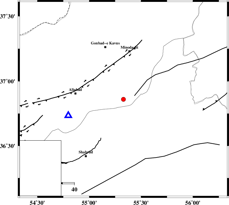
| Location | Lat:36.86 Lon: 55.33 |
| Region | Golestan Province, 24 km South-East of Ramian |
Nearest Cities |
|
| 13 km of Farsian, Golestan Province | |
| 21 km North of Kalateh khanj, Semnan Province | |
| 24 km South East of Ramian, Golestan Province | |
| 25 km South West of Qale-ye qafeh, Golestan Province | |
| 25 km South East of Khanduz, Golestan Province | |
| Depth | 15 km |
| Agency | |
Faults within 150 km: |
|
| ROBATE_QARABIL_F (Length: 168 km) , Distance to epicenter: 10 km | |
| SHAVAR_F (Length: 87 km) , Distance to epicenter: 14 km | |
| KHAZAR_F (Length: 523 km) , Distance to epicenter: 36 km | |
| Number of Phases | 3 |
| RMS | 0 |
| Number of Stations | 3 |
| Error in Latitude | >1.6 km |
| Error in Longitude | 2.4 km |
| Error in Depth | 0 km |
Download waveform in seisan format
to download seisan software Click here
to access information about IIEES stations Click here
Amplitude | ||||||||
| UID | Agency | Station | Component | Amplitude | Period | Arrival Time | Proccessing Time | Signal Clip |
| 78116 | IIEES | MRVT | E | 119.9 | 0.14 | 2011-02-26 15:00:06 | 2011-02-27 04:14:00 | n |
| 78117 | IIEES | DAMV | N | 26.5 | 0.26 | 2011-02-26 15:00:56 | 2011-02-27 04:14:00 | n |
| 78118 | IIEES | DAMV | E | 37.4 | 0.26 | 2011-02-26 15:00:56 | 2011-02-27 04:14:00 | n |
Phase | ||||||||||||
| Agency | Station | Component | Phase Type | Phase Quality | First Motion | Observed Arrival Time | Time Residual | Loc. Flag | Input Weight | Distance | Azimuth | |
| IIEES | MRVT | Z | Pg | E | 2011-02-26 14:59:41 | 0 | y | 111 | 37 | |||
| IIEES | SHRO | Z | Pg | E | 2011-02-26 14:59:42 | 0 | y | 113 | 147 | |||
| IIEES | DAMV | Z | Pn | E | 2011-02-26 15:00:12 | 0 | y | 332 | 247 | |||