
Magnitude |
:3.7 |
| Date & Time (UTC) | 2011-01-30 05:34:59.8 |
| Date & Time (Local) | 1389/11/10 09:04:59.8 |
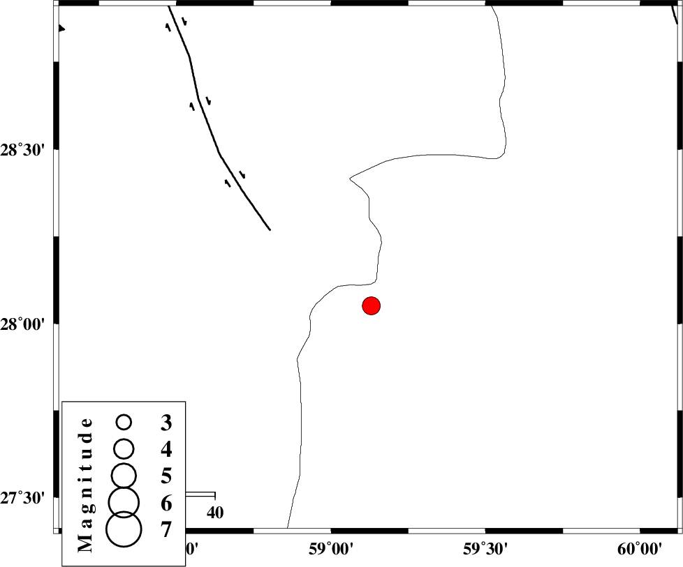
| Location | Lat:28.16 Lon: 59.12 |
| Region | Kerman Province, 142 km North-East of Kahnuj |
Nearest Cities |
|
| 61 km South of Hoseynabad, Kerman Province | |
| 61 km North East of Borj-e abbasabad, Kerman Province | |
| 66 km South East of Mohammadabad-e gonbaki, Kerman Province | |
| 82 km South East of Void, Kerman Province | |
| 84 km North West of Kalemursi, Sistan va Baloochestan Province | |
| Depth | 15 km |
| Agency | |
Faults within 150 km: |
|
| BAM_F (Length: 118 km) , Distance to epicenter: 33 km | |
| KANURAK_F (Length: 135 km) , Distance to epicenter: 100 km | |
| DAMAN_F (Length: 167 km) , Distance to epicenter: 110 km | |
| Number of Phases | 5 |
| RMS | 0.4 |
| Number of Stations | 5 |
| Error in Latitude | >4.6 km |
| Error in Longitude | 3.7 km |
| Error in Depth | 0 km |
Download waveform in seisan format
to download seisan software Click here
to access information about IIEES stations Click here
Amplitude | ||||||||
| UID | Agency | Station | Component | Amplitude | Period | Arrival Time | Proccessing Time | Signal Clip |
| 77666 | IIEES | BNDS | N | 274.7 | 0.55 | 2011-01-30 05:36:28 | 2011-01-30 05:45:00 | n |
| 77667 | IIEES | BNDS | E | 281.1 | 0.59 | 2011-01-30 05:36:40 | 2011-01-30 05:45:00 | n |
Phase | ||||||||||||
| Agency | Station | Component | Phase Type | Phase Quality | First Motion | Observed Arrival Time | Time Residual | Loc. Flag | Input Weight | Distance | Azimuth | |
| IIEES | ZHSF | Z | Pn | E | 2011-01-30 05:35:36 | 0.4 | y | 228 | 45 | |||
| IIEES | BNDS | Z | Pn | E | 2011-01-30 05:35:45 | 0.4 | y | 302 | 254 | |||
| IIEES | KRBR | Z | Pn | E | 2011-01-30 05:35:45 | -0.3 | y | 306 | 312 | |||
| IIEES | CHBR | Z | Pn | E | 2011-01-30 05:35:46 | -0.3 | y | 315 | 154 | |||
| IIEES | SHRT | Z | Pn | E | 2011-01-30 05:36:23 | -0.5 | y | 618 | 10 | |||