
Magnitude |
:5.3 |
| Date & Time (UTC) | 2011-01-28 04:20:36.3 |
| Date & Time (Local) | 1389/11/8 07:50:36.3 |
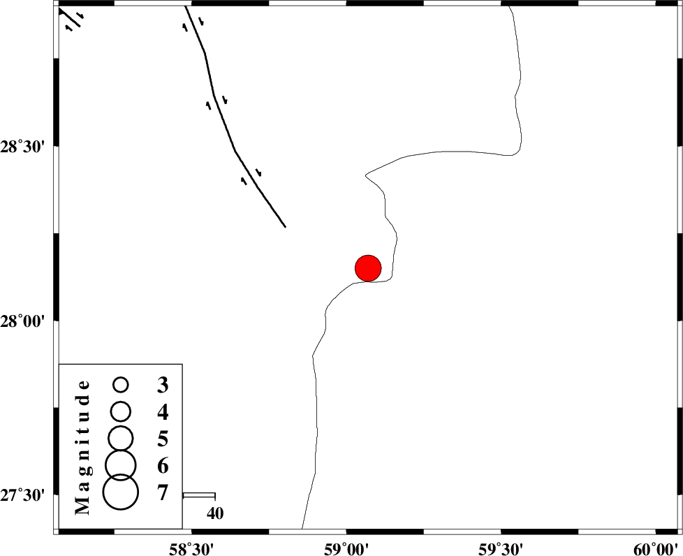
| Location | Lat:28.15 Lon: 59.07 |
| Region | Kerman Province, 137 km North-East of Kahnuj |
Nearest Cities |
|
| 56 km North East of Borj-e abbasabad, Kerman Province | |
| 61 km South of Hoseynabad, Kerman Province | |
| 66 km South East of Mohammadabad-e gonbaki, Kerman Province | |
| 82 km South East of Void, Kerman Province | |
| 85 km North West of Kalemursi, Sistan va Baloochestan Province | |
| Depth | 15 km |
| Agency | |
Faults within 150 km: |
|
| BAM_F (Length: 118 km) , Distance to epicenter: 29 km | |
| KANURAK_F (Length: 135 km) , Distance to epicenter: 104 km | |
| DAMAN_F (Length: 167 km) , Distance to epicenter: 115 km | |
| Number of Phases | 5 |
| RMS | 0.3 |
| Number of Stations | 5 |
| Error in Latitude | >4.2 km |
| Error in Longitude | 2.8 km |
| Error in Depth | 0 km |
Download waveform in seisan format
to download seisan software Click here
to access information about IIEES stations Click here
Amplitude | ||||||||
| UID | Agency | Station | Component | Amplitude | Period | Arrival Time | Proccessing Time | Signal Clip |
| 77547 | IIEES | BNDS | E | 14547.7 | 0.39 | 2011-01-28 04:22:09 | 2011-01-28 04:34:00 | n |
| 77548 | IIEES | BNDS | N | 10089.9 | 0.99 | 2011-01-28 04:22:10 | 2011-01-28 04:34:00 | n |
| 77549 | IIEES | KRBR | E | 8242.7 | 0.58 | 2011-01-28 04:22:08 | 2011-01-28 04:34:00 | n |
Phase | ||||||||||||
| Agency | Station | Component | Phase Type | Phase Quality | First Motion | Observed Arrival Time | Time Residual | Loc. Flag | Input Weight | Distance | Azimuth | |
| IIEES | ZHSF | Z | P | E | 2011-01-28 04:21:13 | 0.2 | y | 233 | 45 | |||
| IIEES | BNDS | Z | Pn | E | 2011-01-28 04:21:21 | 0.4 | y | 297 | 255 | |||
| IIEES | KRBR | Z | Pn | E | 2011-01-28 04:21:21 | -0.3 | y | 303 | 313 | |||
| IIEES | CHBR | Z | Pn | E | 2011-01-28 04:21:22 | -0.2 | y | 316 | 153 | |||
| IIEES | GHIR | Z | Pn | E | 2011-01-28 04:21:57 | -0.2 | y | 597 | 273 | |||