
Magnitude |
:3.9 |
| Date & Time (UTC) | 2011-01-27 23:12:52.8 |
| Date & Time (Local) | 1389/11/8 02:42:52.8 |
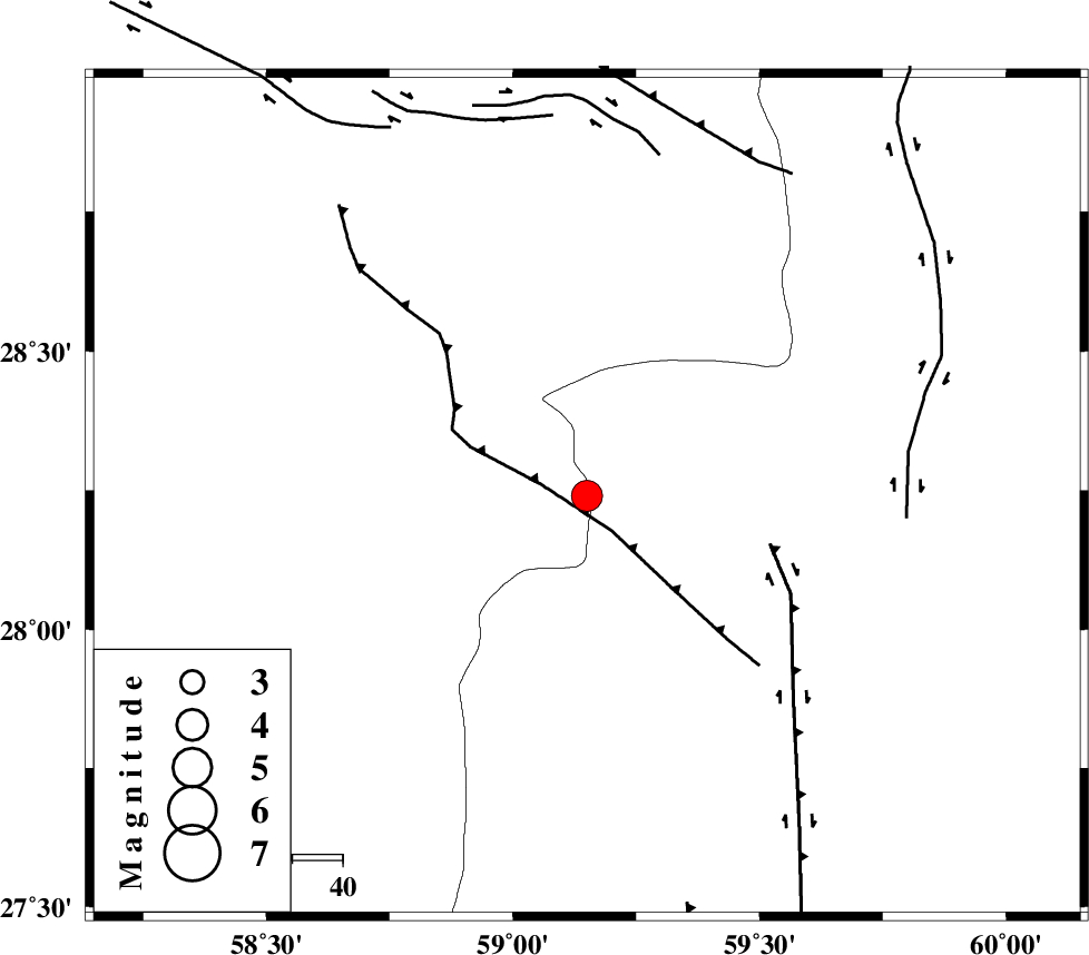
| Location | Lat:28.24 Lon: 59.15 |
| Region | Kerman Province, 123 km South-East of Bam |
Nearest Cities |
|
| 52 km South of Hoseynabad, Kerman Province | |
| 60 km South East of Mohammadabad-e gonbaki, Kerman Province | |
| 67 km North East of Borj-e abbasabad, Kerman Province | |
| 74 km South East of Void, Kerman Province | |
| 84 km South East of Fahroj, Kerman Province | |
| Depth | 15 km |
| Agency | |
Faults within 150 km: |
|
| BAM_F (Length: 118 km) , Distance to epicenter: 34 km | |
| KANURAK_F (Length: 135 km) , Distance to epicenter: 91 km | |
| DAMAN_F (Length: 167 km) , Distance to epicenter: 105 km | |
| Number of Phases | 5 |
| RMS | 0.1 |
| Number of Stations | 5 |
| Error in Latitude | >4.3 km |
| Error in Longitude | 1.2 km |
| Error in Depth | 0 km |
Download waveform in seisan format
to download seisan software Click here
to access information about IIEES stations Click here
Amplitude | ||||||||
| UID | Agency | Station | Component | Amplitude | Period | Arrival Time | Proccessing Time | Signal Clip |
| 77494 | IIEES | KRBR | N | 463.3 | 0.44 | 2011-01-27 23:14:21 | 2011-01-27 11:34:00 | n |
| 77495 | IIEES | KRBR | E | 412.8 | 0.52 | 2011-01-27 23:14:25 | 2011-01-27 11:34:00 | n |
| 77496 | IIEES | BNDS | N | 422.9 | 0.48 | 2011-01-27 23:14:24 | 2011-01-27 11:34:00 | n |
| 77497 | IIEES | BNDS | E | 496.5 | 0.64 | 2011-01-27 23:14:30 | 2011-01-27 11:34:00 | n |
Phase | ||||||||||||
| Agency | Station | Component | Phase Type | Phase Quality | First Motion | Observed Arrival Time | Time Residual | Loc. Flag | Input Weight | Distance | Azimuth | |
| IIEES | ZHSF | Z | Pn | E | 2011-01-27 23:13:27 | 0 | y | 220 | 46 | |||
| IIEES | KRBR | Z | Pn | E | 2011-01-27 23:13:38 | 0.1 | y | 302 | 310 | |||
| IIEES | BNDS | Z | Pn | E | 2011-01-27 23:13:38 | 0.1 | y | 308 | 253 | |||
| IIEES | GHIR | Z | Pn | E | 2011-01-27 23:14:15 | -0.2 | y | 604 | 272 | |||
| IIEES | SHRT | Z | Pn | E | 2011-01-27 23:14:16 | 0 | y | 609 | 10 | |||