
Magnitude |
:3.1 |
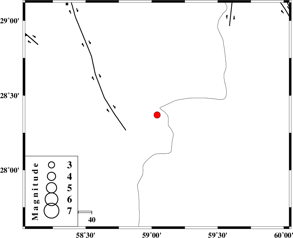
| Date & Time (UTC) | 2011-01-27 10:06:00.3 |
| Date & Time (Local) | 1389/11/7 13:36:00.3 |
| Location | Lat:28.37 Lon: 59.04 |
| Region | Kerman Province, 106 km South-East of Bam |
Nearest Cities |
|
| 37 km South of Hoseynabad, Kerman Province | |
| 42 km South East of Mohammadabad-e gonbaki, Kerman Province | |
| 57 km South East of Void, Kerman Province | |
| 64 km North East of Borj-e abbasabad, Kerman Province | |
| 67 km South East of Fahroj, Kerman Province | |
| Depth | 15 km |
| Agency | |
Faults within 150 km: |
|
| BAM_F (Length: 118 km) , Distance to epicenter: 26 km | |
| KANURAK_F (Length: 135 km) , Distance to epicenter: 85 km | |
| GOWK_F (Length: 152 km) , Distance to epicenter: 102 km | |
| Number of Phases | 5 |
| RMS | 0.5 |
| Number of Stations | 5 |
| Error in Latitude | >6.3 km |
| Error in Longitude | 4.8 km |
| Error in Depth | 0 km |
Download waveform in seisan format
to download seisan software Click here
to access information about IIEES stations Click here
Amplitude | ||||||||
| UID | Agency | Station | Component | Amplitude | Period | Arrival Time | Proccessing Time | Signal Clip |
| 77397 | IIEES | KRBR | E | 71.8 | 0.44 | 2011-01-27 10:07:27 | 2011-01-27 10:48:00 | n |
| 77398 | IIEES | BNDS | E | 70.2 | 0.43 | 2011-01-27 10:07:22 | 2011-01-27 10:48:00 | n |
| 77399 | IIEES | BNDS | N | 118.8 | 0.34 | 2011-01-27 10:07:25 | 2011-01-27 10:48:00 | n |
Phase | ||||||||||||
| Agency | Station | Component | Phase Type | Phase Quality | First Motion | Observed Arrival Time | Time Residual | Loc. Flag | Input Weight | Distance | Azimuth | |
| IIEES | ZHSF | Z | Pn | E | 2011-01-27 10:06:35 | 0 | y | 218 | 50 | |||
| IIEES | KRBR | Z | Pn | E | 2011-01-27 10:06:44 | 0.6 | y | 285 | 309 | |||
| IIEES | BNDS | Z | Pn | E | 2011-01-27 10:06:45 | -0.5 | y | 302 | 250 | |||
| IIEES | CHBR | Z | Pn | E | 2011-01-27 10:06:50 | 0.3 | y | 339 | 155 | |||
| IIEES | SHRT | Z | Pn | E | 2011-01-27 10:07:21 | -0.6 | y | 597 | 11 | |||