
Magnitude |
:4.1 |
| Date & Time (UTC) | 2011-01-27 08:57:54.4 |
| Date & Time (Local) | 1389/11/7 12:27:54.4 |
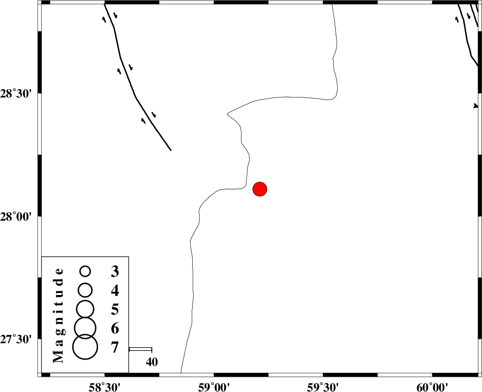
| Location | Lat:28.11 Lon: 59.21 |
| Region | Sistan va Baloochestan Province, 150 km North-East of Kahnuj |
Nearest Cities |
|
| 67 km South East of Hoseynabad, Kerman Province | |
| 69 km North East of Borj-e abbasabad, Kerman Province | |
| 75 km South East of Mohammadabad-e gonbaki, Kerman Province | |
| 76 km North West of Kalemursi, Sistan va Baloochestan Province | |
| 90 km South East of Void, Kerman Province | |
| Depth | 15 km |
| Agency | |
Faults within 150 km: |
|
| BAM_F (Length: 118 km) , Distance to epicenter: 43 km | |
| KANURAK_F (Length: 135 km) , Distance to epicenter: 102 km | |
| KASKIN_F (Length: 100 km) , Distance to epicenter: 102 km | |
| Number of Phases | 5 |
| RMS | 0.7 |
| Number of Stations | 5 |
| Error in Latitude | >9.4 km |
| Error in Longitude | 7.7 km |
| Error in Depth | 0 km |
Download waveform in seisan format
to download seisan software Click here
to access information about IIEES stations Click here
Amplitude | ||||||||
| UID | Agency | Station | Component | Amplitude | Period | Arrival Time | Proccessing Time | Signal Clip |
| 77378 | IIEES | BNDS | N | 741.4 | 0.46 | 2011-01-27 08:59:22 | 2011-01-27 09:11:00 | n |
| 77379 | IIEES | KRBR | E | 541.8 | 0.29 | 2011-01-27 08:59:24 | 2011-01-27 09:11:00 | n |
| 77380 | IIEES | KRBR | N | 542.9 | 0.43 | 2011-01-27 08:59:26 | 2011-01-27 09:11:00 | n |
Phase | ||||||||||||
| Agency | Station | Component | Phase Type | Phase Quality | First Motion | Observed Arrival Time | Time Residual | Loc. Flag | Input Weight | Distance | Azimuth | |
| IIEES | ZHSF | Z | Pn | E | 2011-01-27 08:58:30 | 0.7 | y | 225 | 42 | |||
| IIEES | CHBR | Z | Pn | E | 2011-01-27 08:58:39 | -0.5 | y | 306 | 155 | |||
| IIEES | BNDS | Z | Pn | E | 2011-01-27 08:58:41 | 0.8 | y | 310 | 256 | |||
| IIEES | KRBR | Z | Pn | E | 2011-01-27 08:58:40 | -0.7 | y | 316 | 312 | |||
| IIEES | SHRT | Z | Pn | E | 2011-01-27 08:59:18 | -0.6 | y | 622 | 9 | |||